Transvaal and OFS and Southern Africa Physical and Mineral Map F Bianconi 1899 Digital Download Transvaal and OFS and Southern Africa Physical and Mineral Map F Bianconi 1899 Digital Download Transvaal and OFS and Southern Africa Physical and Mineral Map F Bianconi 1899 Digital Download Transvaal and OFS and Southern Africa Physical and Mineral Map F Bianconi 1899 Digital Download Transvaal and OFS and Southern Africa Physical and Mineral Map F Bianconi 1899 Digital Download

Transvaal and OFS and Southern Africa Physical and Mineral Map F Bianconi 1899 Digital Download

Digital product
1 available / refurbished
R295.00
Shipping
This is a digital product (eg. voucher, product license, service, etc.) and does not require shipping. The seller will be in contact to deliver this product to you electronically.
The seller has indicated that they will usually have this item ready to ship within 3 business days. Shipping time depends on your delivery address. The most accurate delivery time will be calculated at checkout, but in general, the following shipping times apply:
 
Standard Delivery
Main centres:  1-3 business days
Regional areas: 3-4 business days
Remote areas: 3-5 business days
Seller
Buyer protection
Get it now, pay later

Product details

Condition
Refurbished
Location
South Africa
Area
Africa
Time Period
1800s
Type
Political Map
Product code
8325359
Bob Shop ID
641851180

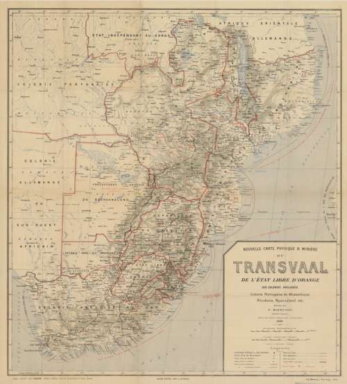
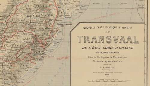
Title: Transvaal & OFS and Southern Africa Physical & Mineral Map F Bianconi 1899 Digital Download.
Map By: F Bianconi, Geographical Engineer.
Publisher: Depot Central, A Taride: Libraire Editeur, St Denis, Paris.
Year Published: 1899.
Scale: @ 1: 3 000 000. 
File Type and Size:  TIF File 132MB and JPG 20MB File Images.
Printed Size: Can be printed up to A2 / A1 Size.
Info: Nouvelle Carte Physique & Miniere du Transvaal, de l'Etat Libre d'Orange, des Colonies Anglaises, Colonie Portugaise de Mozambique, Rhodesia, Nyassaland etc.
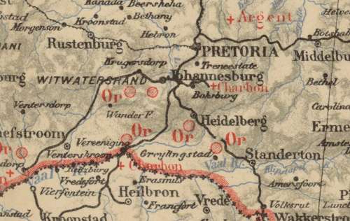
A Map showing Southern Africa with a focus on Mineral and country boundaries of the time. All country and city names in French, a well detailed and interesting map.
Condition: Digital Download.
Price: R 295.00.00 Inc Vat.
Please Note: 

On completion of the order a link will be forwarded to your e-mail address for downloading of the file.
Large image files require sufficient processing power and memory capabilities to render efficiently on the screen. 
Prior to printing please ensure that the printer has sufficient RAM for processing the image.


Add to cart

Recently viewed

See more
Socket dil 0.6 d-leaf w/wrap s40 icn-406-wb-t *d*
R9.89
MSI GeForce RTX 5070 VANGUARD SOC Launch Edition 12GB Graphics Card
R22,197.28
DDR 1954 COAT OF ARMS OFFICIAL STAMPS
R2.00
Ic dip16 quad multiplexer 3-state out 16-pin 74s258
R3.80

Similar products

National Geographic Africa 1962 Poster Map Digital Download
R295.00
Jeppe`s Transvaal 1899 6 x Maps Digital Download
R425.00
The Daily Mail Transvaal and Orange Free State Map 1899 Digital Download
R295.00
Malawi, Rhodesia & Zambia 1966 & Southern Africa National Geographic 1962 2 x Maps Digital Download
R195.00