Union of South Africa Map 1910 by W and AK Johnston Digital Download
Digital product
New
1 was available
R295.00
0% off
Shipping
This is a digital product (eg. voucher, product license, service, etc.) and does not require shipping.
The seller will be in contact to deliver this product to you electronically.
The seller has indicated that they will usually have this item
ready to ship within 3 business days.
Shipping time depends on your delivery address.
The most accurate delivery time will be calculated at checkout,
but in general, the following shipping times apply:
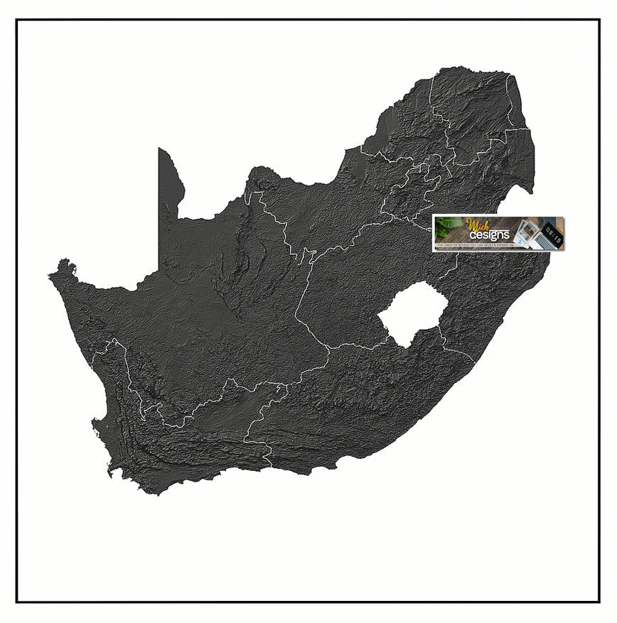
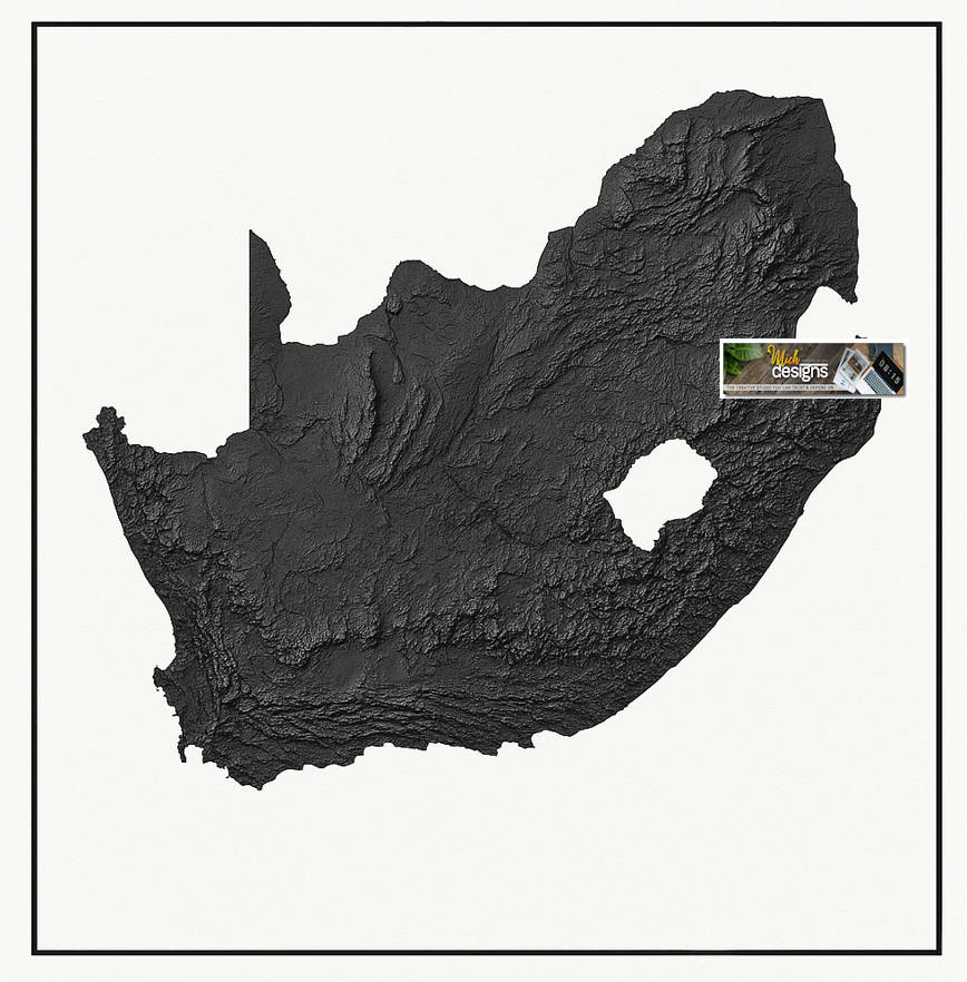
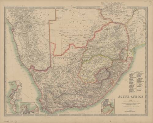
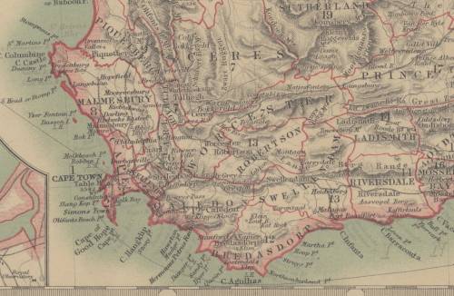
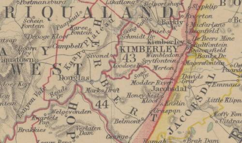
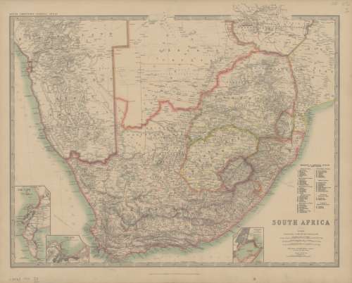
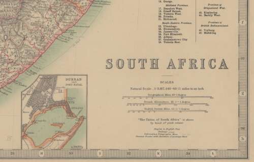
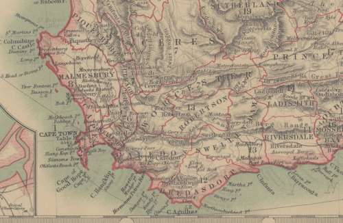
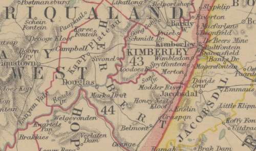
Title: Union of South Africa Map 1910 by W & AK Johnston Digital Download. Map By: W & AK Johnston Limited. Publisher: Engraved, Printed and Published by W. & A. K. Johnston, Limited, Edinburgh & London. Year Published: 1910 / Keith Johnston's General Atlas. Scale: 1: 3 817 440 // 60.25 Miles to the Inch. File Type and Size: JP2 File 35MB and JPG 22MB File Images. Printed Size: Can be printed up to A2 / A1 Size Info: A Map of the Union Of South Africa. A map that contains 3 bar scales in "Geographical Miles," "French Kilomètres," and "English Statute Miles." There are references to Electoral divisions in Cape Colony. With 3 inset maps of the Durban and Port Natal, Cape Town and Table Bay as well as the Cape Peninsula. The Map shows railways, submarine telegraphs, steamer routes with duration of passage, districts, various regional names and waterways. Condition: Digital Download. Price: R 295.00.00 Inc Vat.
Please Note: On completion of the order a link will be forwarded to your e-mail address for downloading of the file. Large image files require sufficient processing power and memory capabilities to render efficiently on the screen. JP2 Files can be viewed with Irfan View or GIMP, free Open Source Graphic Viewers and editors. Prior to printing please ensure that the printer has sufficient RAM for processing the image.