

.png)
| Main centres: | 1-3 business days |
| Regional areas: | 3-4 business days |
| Remote areas: | 3-5 business days |
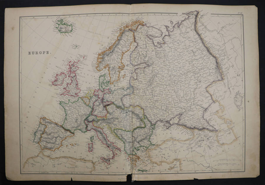
c. 1846
Hand coloured woodcut from the Illustrated London News. The Illustrated London News was founded by Herbert Ingram in 1842. The woodcut prints were made within 7 days for their weekly issue, although this map was likely a longer commission.
Dimensions: 25 cm x 38 cm.

.png)