This item has closed with no items sold
View the relisted Item
View the relisted Item
View other items offered by CapeCollectables1030
Similar products
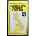
Vintage Folded Map Motorists` Map of West Country & South Wales, #1 First Edition 1977.
Secondhand
R155.00
Closed
13 Apr 24 09:16
Shipping
Standard courier shipping from R30
R30 Standard shipping using one of our trusted couriers applies to most areas in South Africa. Some areas may attract a R30 surcharge. This will be calculated at checkout if applicable.
Check my rate
Check my rate
Free collection from
Kuils River, Cape Town
The seller allows collection for this item and will be in contact with the full collection address once the order is ready.
Ready for collection by Thursday, 2 May.
Ready to ship in
The seller has indicated that they will usually have this item
ready to ship within 3 business days. Shipping time depends on your delivery address. The most
accurate delivery time will be calculated at checkout, but in
general, the following shipping times apply:
Standard Delivery
| Main centres: | 1-3 business days |
| Regional areas: | 3-4 business days |
| Remote areas: | 3-5 business days |
Buyer Protection
How you're covered
Get it now, pay later
Returns
Product information
Condition:
Secondhand
Location:
South Africa
Area:
Europe
Time Period:
Post-1950
Type:
Road Map
Bob Shop ID:
609709967
Title: Vintage Folded Map Motorists' Map of West Country & South Wales, #1 First Edition 1977.
Publisher: BTA British Tourist Authority, 1977.
Designed and Produced By: Cartographic Unit (Publications Division) of the Automobile Association England. Based Upon Ordnance Survey Maps.
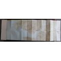
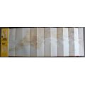
Format: Folded Map. Double Sided Map.
Height: 41cm.
Width: 114cm.
Info: Special folding System for easy viewing. Number 1 of a series of 6 Maps. Very clean and easy to read map.
Includes Insets of the Isles of Scilly.
Suitable for framing a specific area on a map and displaying in the bar.
Scale: 5 miles to 1 Inch.
Condition: Very Good condition, never used.
Price: R 155.00 Inc Vat.
