This item has closed with no items sold
View the relisted Item
View the relisted Item
View other items offered by CapeCollectables1033
Vintage Map of County of Hampshire England, by Wrightsons Foil Graphics
Secondhand
R495.00
Closed
4 May 24 17:16
Shipping
Standard courier shipping from R30
R30 Standard shipping using one of our trusted couriers applies to most areas in South Africa. Some areas may attract a R30 surcharge. This will be calculated at checkout if applicable.
Check my rate
Check my rate
Free collection from
Kuils River, Cape Town
The seller allows collection for this item and will be in contact with the full collection address once the order is ready.
Ready for collection by Monday, 20 May.
Ready to ship in
The seller has indicated that they will usually have this item
ready to ship within 3 business days. Shipping time depends on your delivery address. The most
accurate delivery time will be calculated at checkout, but in
general, the following shipping times apply:
Standard Delivery
| Main centres: | 1-3 business days |
| Regional areas: | 3-4 business days |
| Remote areas: | 3-5 business days |
Returns
Get it now, pay later
Seller
Buyer Protection
Product details
Condition
Secondhand
Location
South Africa
Area
Europe
Time Period
Post-1950
Type
Political Map
Bob Shop ID
611752324
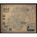
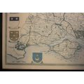
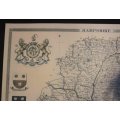
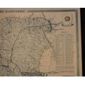
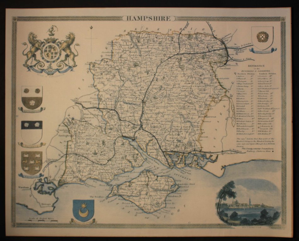
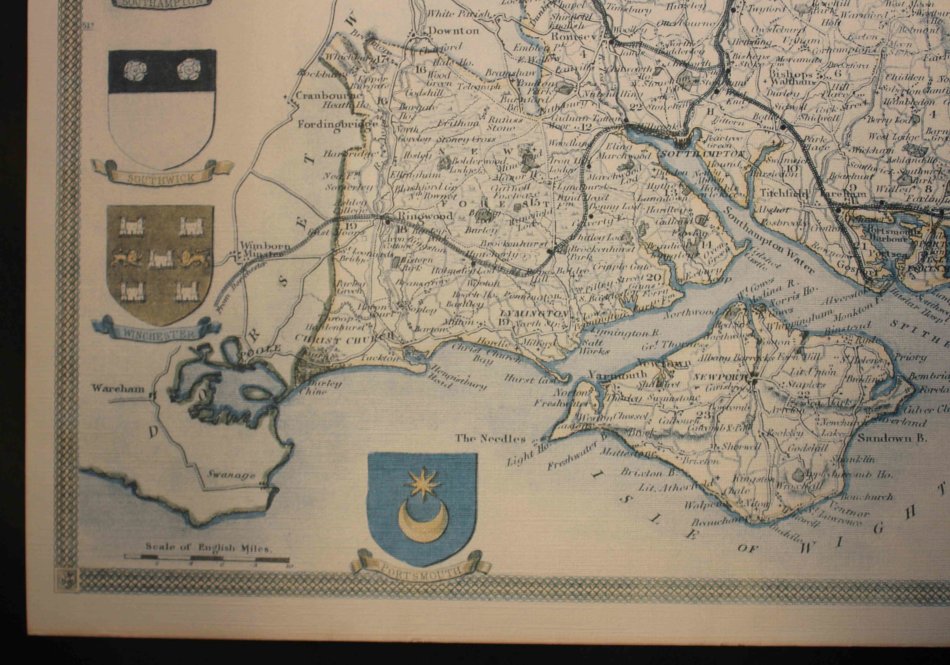
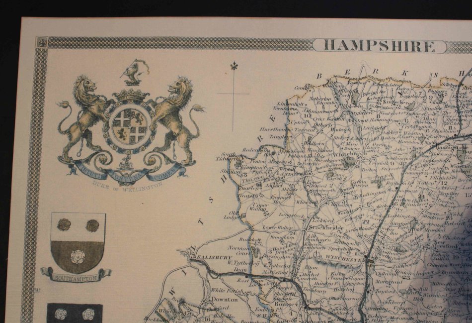
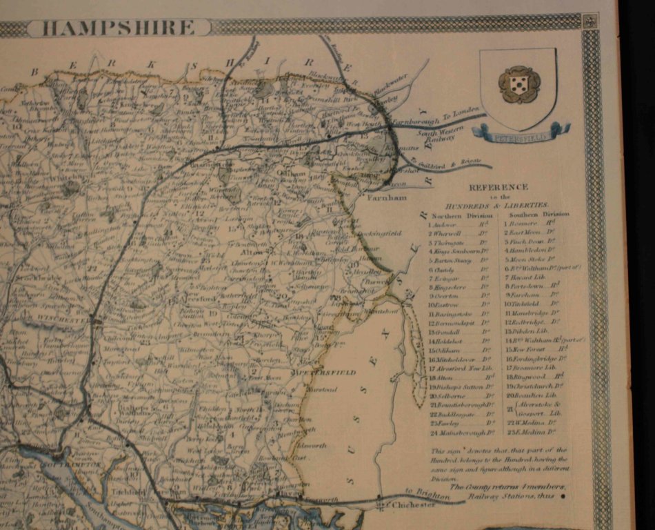
Title: Vintage Map of County of Hampshire England, by Wrightsons Foil Graphics.
Publisher: Wrightsons Foil Graphics of London.
Printed By: Wrightsons Foilgraphics London HA4 OYB.
Type: Print: Foil Graphic Dry Printing.
Size: 40cm high x 50cm wide.
Condition: Very Good.
Format: Printed map of the Hampshire county with Duke of Wellington Coat Of Arms and vignette of Southampton with Portsmouth, Southampton, Southwick, Winchester and Petersfield Coat of Arms.
A reproduction of a Thomas Moule map @ 1840's.
A decorative Victorian map of the county that was first published in Barclay's Complete & Universal English Dictionary. (London: 1840s)
Map: Fine Printed Reproduction of an Original release.
Price: R 495.00 Inc Vat.
![]()
![]()