Vintage Surveys and Exploration Map of Africa 1909 1 x Map Digital Download
Digital product
New
1 was available
R195.00
0% off
Shipping
This is a digital product (eg. voucher, product license, service, etc.) and does not require shipping.
The seller will be in contact to deliver this product to you electronically.
The seller has indicated that they will usually have this item
ready to ship within 3 business days.
Shipping time depends on your delivery address.
The most accurate delivery time will be calculated at checkout,
but in general, the following shipping times apply:
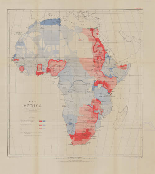
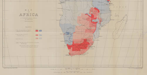
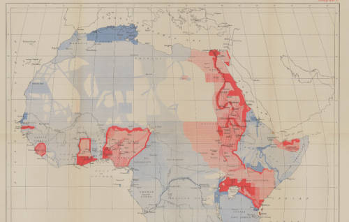
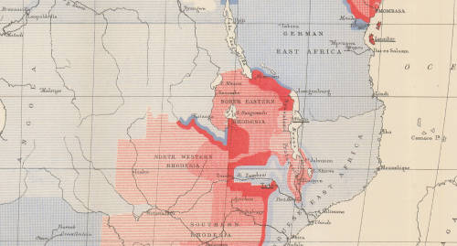
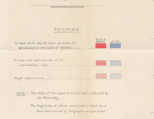
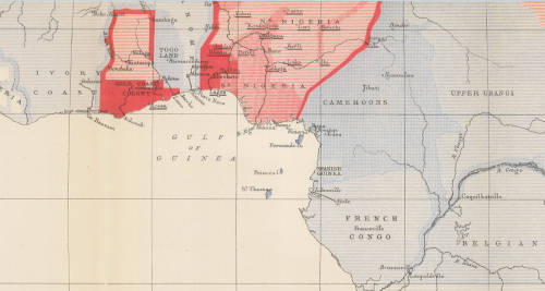
Title: Vintage Surveys and Exploration Map of Africa 1909 1 x Map Digital Download. Publisher: Drawn and printed at the War Office 1909, Corrected Sept 1913. Format: Vintage Printed Map that has been scanned and saved as a Tiff image. Printed Size on a large format printer would be as follows:- Height: @ 90cm. Width: 75cm. Can print up to A0 Size on a large format printer. Total Number of Files: 1 x Tiff images @ 16MB. Info: A Map of Africa to illustrate the progress of Surveys and Explorations. The whole of the coast line has been charted by the Admiralty. Geographical Section, General Staff No 2436 Scale: 1: 20 000 000 / 1 cm = 200Km's. Condition: Digital Download. Price: R 195.00 Inc Vat. On completion of the order and receipt of payment a WeTransfer link will be forwarded to your e-mail address for downloading of the file.