This item has closed 1 buyer bought 1 item
View other items offered by CapeCollectables1315

Similar products

1922 Map of The World - Political - Excellent Condition, Original Bartholomew Map
Secondhand
R645.00
Political Globe with Stand - World Map
New
R199.30
National Geographic Africa 2000 Poster Map Digital Download
New
R295.00
The Men Who Mapped the World (with removable maps)
New
R450.00
World Political Map In Tube Poster Size World Political Map In Tube Poster Size World Political Map In Tube Poster Size World Political Map In Tube Poster Size
Sold

World Political Map In Tube Poster Size

New 1 was available
R340.00
Shipping
Free shipping is available from CapeCollectables for all orders above R1,500.00, using one of our trusted couriers.
Check my rate
The seller allows collection for this item. Buyers will receive the collection address and time once the order is ready.
The seller has indicated that they will usually have this item ready to ship within 3 business days. Shipping time depends on your delivery address. The most accurate delivery time will be calculated at checkout, but in general, the following shipping times apply:
 
Standard Delivery
Main centres:  1-3 business days
Regional areas: 3-4 business days
Remote areas: 3-5 business days
Buyer protection
Returns
Money-Back Guarantee: 7 Days: Excludes Cost Of Shipping
Get it now, pay later

Product details

Condition
New
Location
South Africa
Area
Multiple Regions
Time Period
Post-1950
Type
Political Map
Customer ratings:
Bob Shop ID
586300414

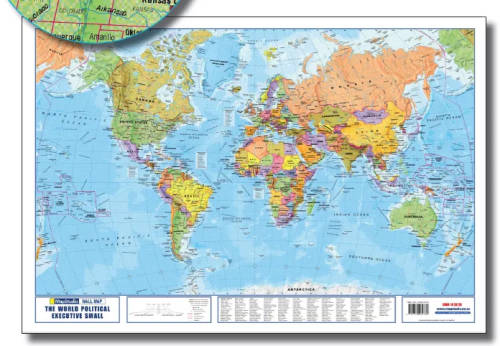
Title: World Political Map In Tube Poster Size.
Publisher: Map Studio.
Format: Colour Poster in Tube.
Height: 69cm.
Width: 100cm.
Edition: 10th Edition.
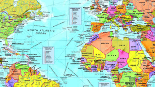
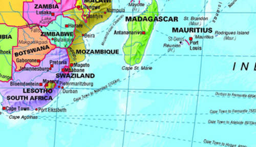
Info: Content and coverage of this updated World Political Poster Tube Map shows brightly colour-coded countries with relief, capital cities, major cities and towns, rivers, seas, lakes with names, international boundaries, state boundaries, disputed boundaries, undefined country boundaries, international date line, shipping routes with distances, latitude and longitude markings, alphabetical listing of all countries and their capital cities, time zones indicated with easy-to-use clocks, island names and ocean depths.
Packaged in a convenient tube.
The wall map is not only educational, but very decorative as well. Great for classroom display or at home. Ideal for young or old and a great interactive activity.
Scale: 1: 40 000 000
Condition: New Map, not laminated.
Price: R 340.00 Inc Vat.


Recently viewed

See more
14k / 14ct gold map of Africa PENDANT: elephant
New
R5,299.00 No bids
49% OFF
Stainless steel Solar floor lamp 10pcs Solar Light Set (Floor Mount Pack of 1)
New
R350.00 R690.00
45% OFF
1Pc Beige For iPhone 13 Pro African Wild Dog Phone Case
New
R170.00 R309.00
Fujitsu LifeBook A530 A531 AH530 AH531 LH520 LH530 PH521 - 10.8V Replacement Laptop Battery
New
R849.00

Customer ratings: 1 ratings

Very Happy with my Purchase! I bought it as a present for my daughter she loves it
24 May 2023