This item has closed with no items sold
View other items offered by Heritage Trades1206

Similar products

FRANCE by Thomas Jefferys (1772)
Closed

‘FRANCE’ by Thomas Jefferys (1772)

Secondhand 1 was available
R1,250.00
Shipping
R35.00 Standard shipping using one of our trusted couriers applies to most areas in South Africa. Some areas may attract a R30.00 surcharge. This will be calculated at checkout if applicable.
Check my rate
The seller allows collection for this item. Buyers will receive the collection address and time once the order is ready.
The seller has indicated that they will usually have this item ready to ship within 2 business days. Shipping time depends on your delivery address. The most accurate delivery time will be calculated at checkout, but in general, the following shipping times apply:
 
Standard Delivery
Main centres:  1-3 business days
Regional areas: 3-4 business days
Remote areas: 3-5 business days
Buyer protection
Get it now, pay later

Product details

Condition
Secondhand
Location
South Africa
Product code
bhd2
Bob Shop ID
654865622

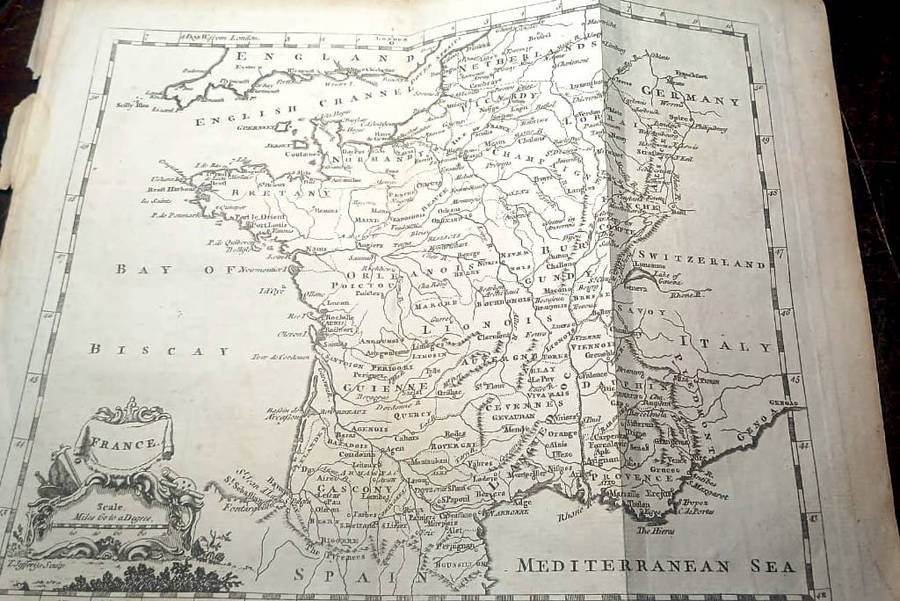
An attractive 18th century map of France by Thomas Jefferys, published in Thomas Salmons A New Geographical and Historical Grammar (London: 1749-1772).

  • This is an original copperplate engraving with later hand colour.
  • Printed area is approximately 22.2cms by 18cms.


Thomas Jefferys (c.1695-1771) was an outstanding 18th century cartographer and publisher whose prolific output ranged from 1 inch to 1 mile county maps to some of the finest maps of the time of North America. He enjoyed a very high reputation for his work and was appointed Geographer to the Prince of Wales and George III.

Recently viewed

See more