| Main centres: | 1-3 business days |
| Regional areas: | 3-4 business days |
| Remote areas: | 3-5 business days |
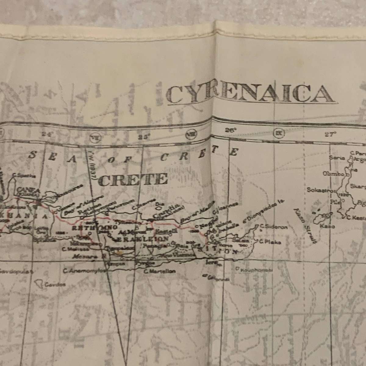
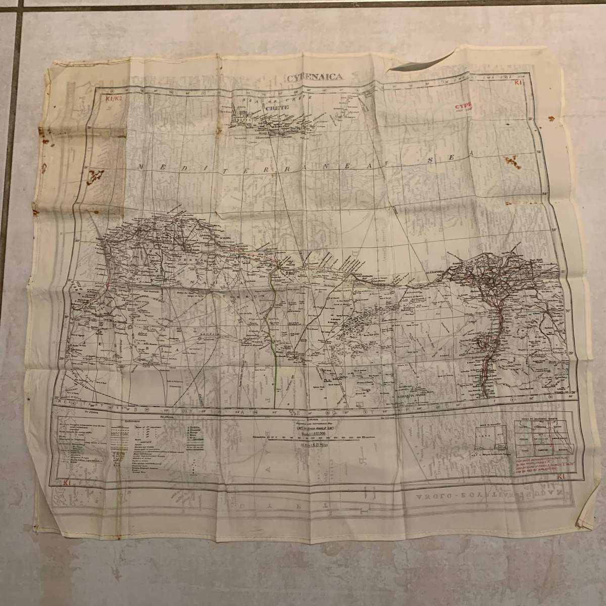
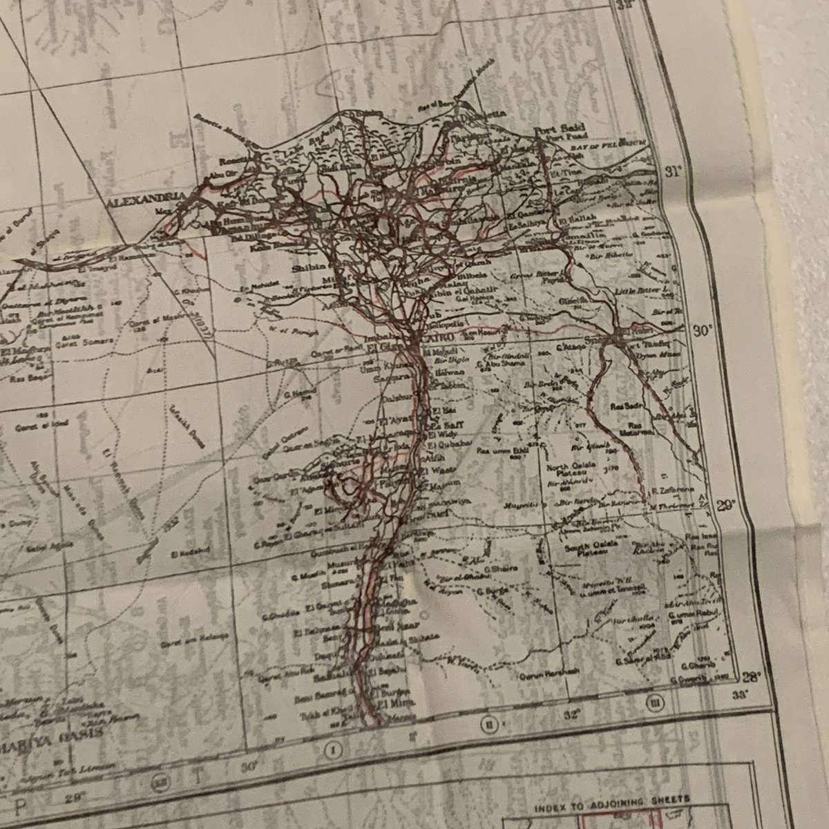
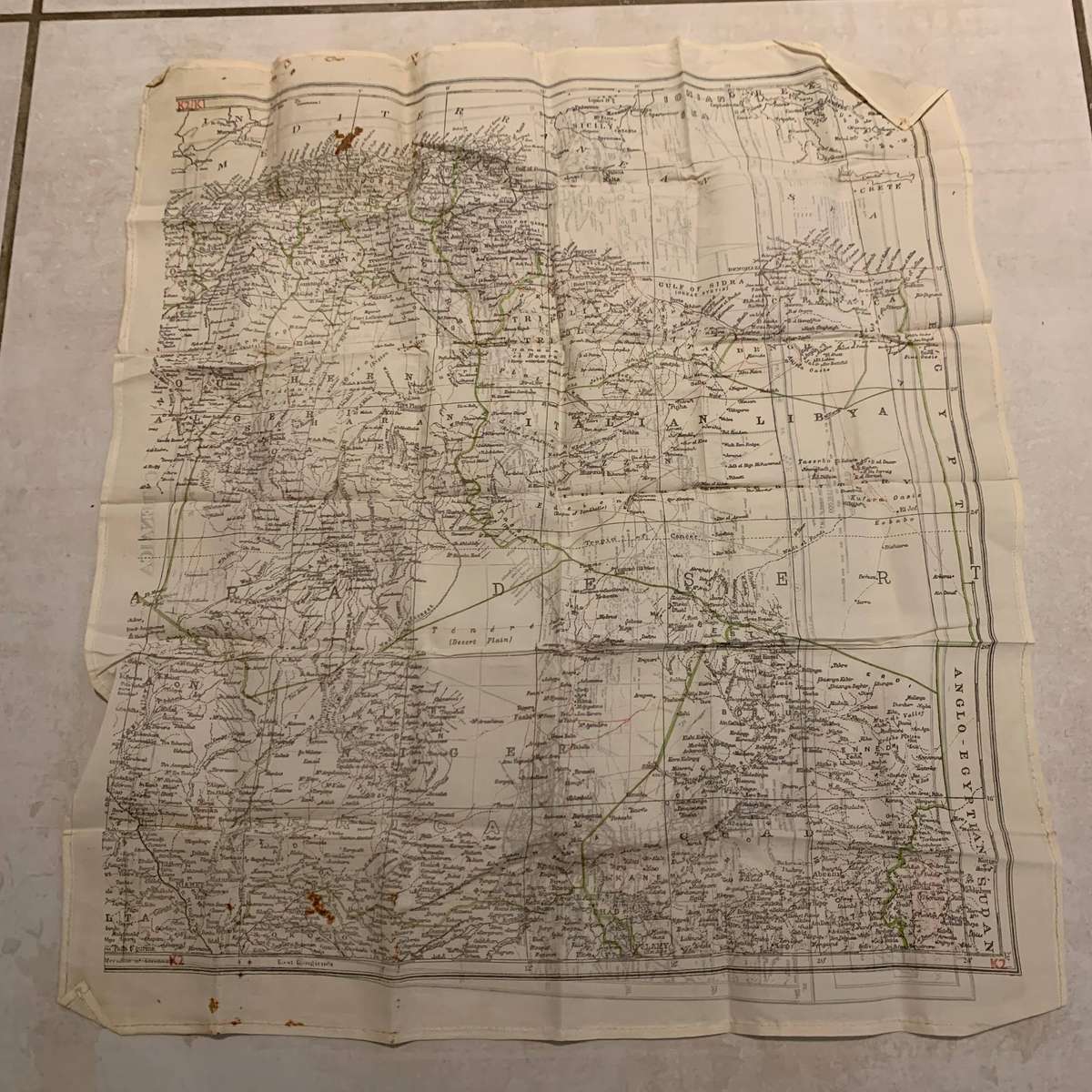
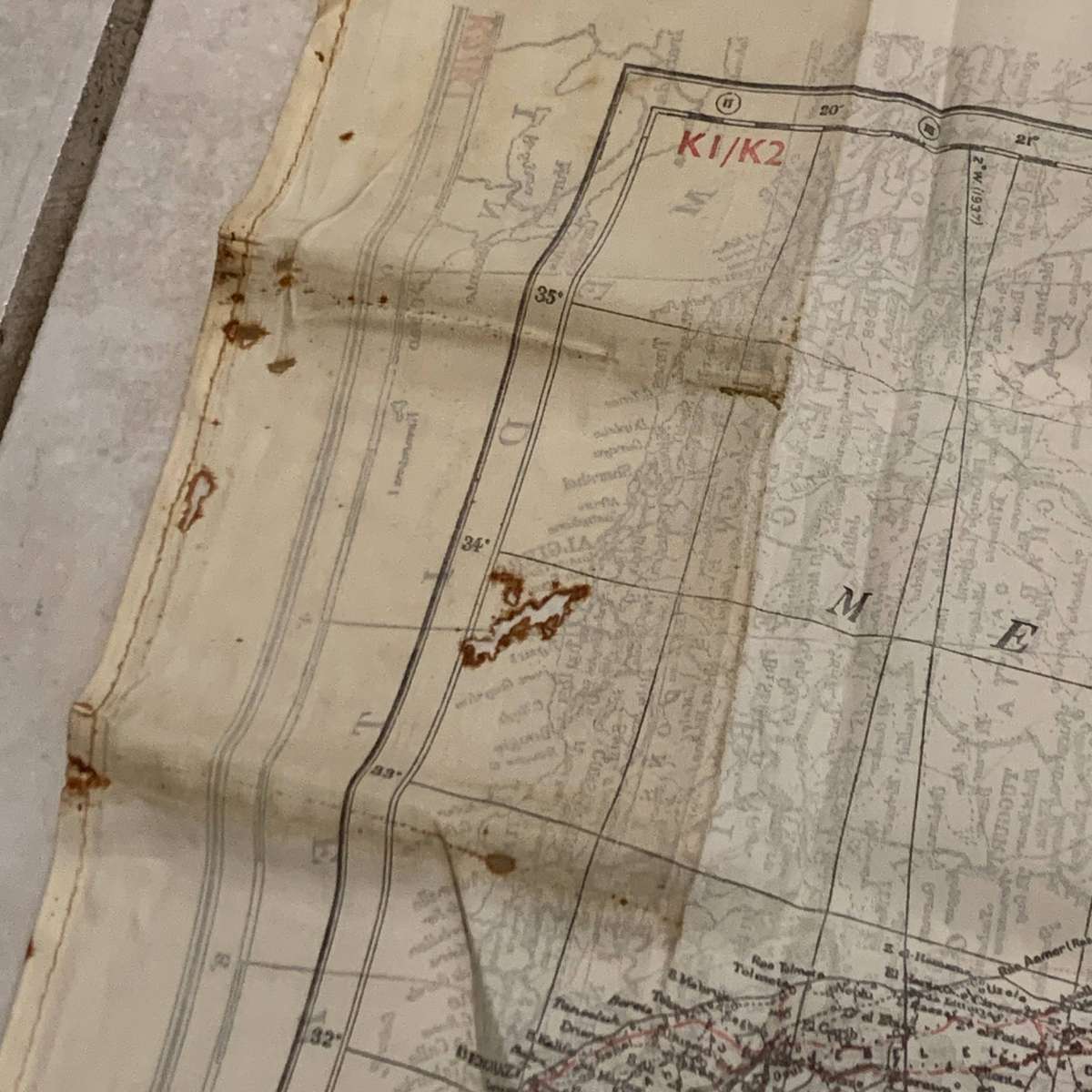
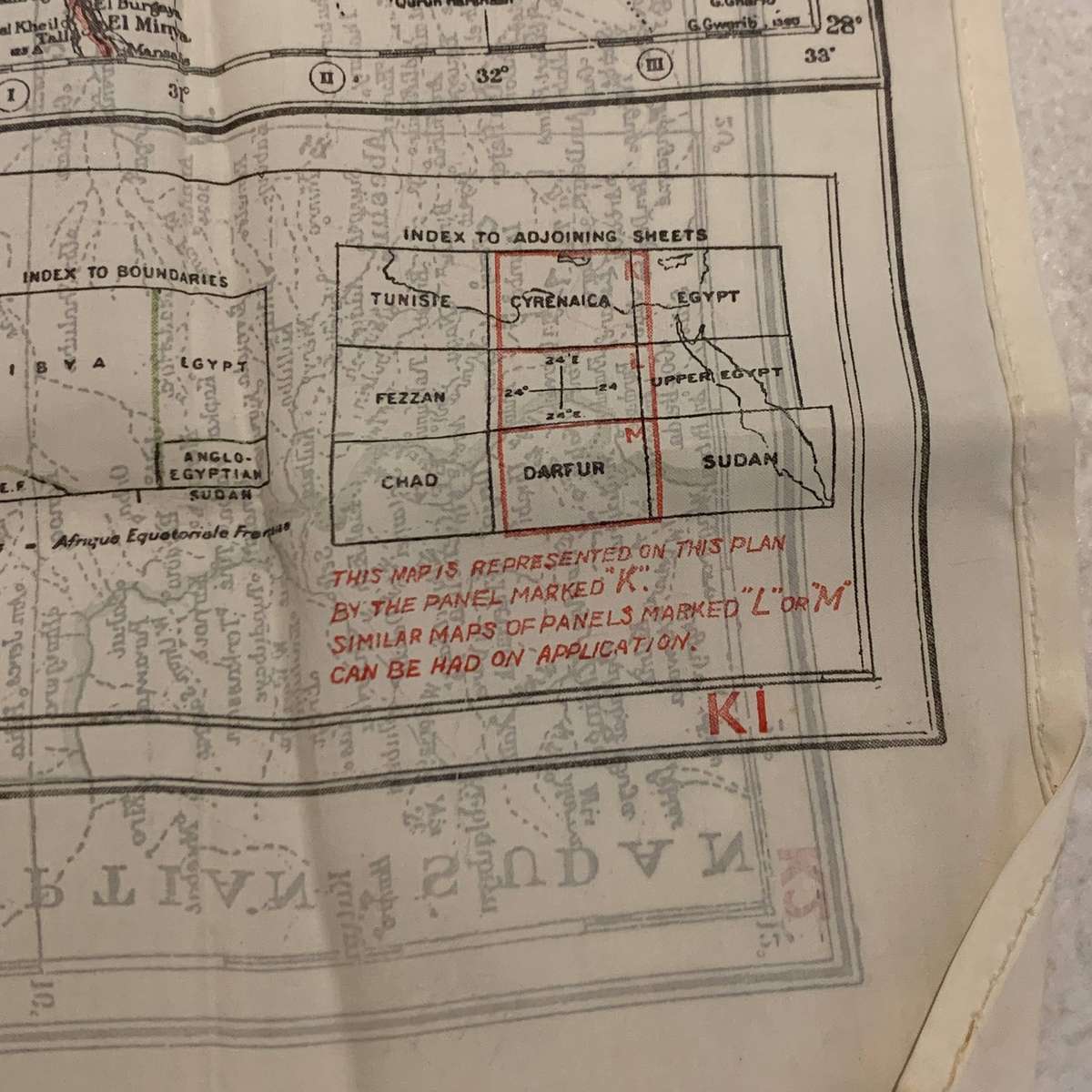
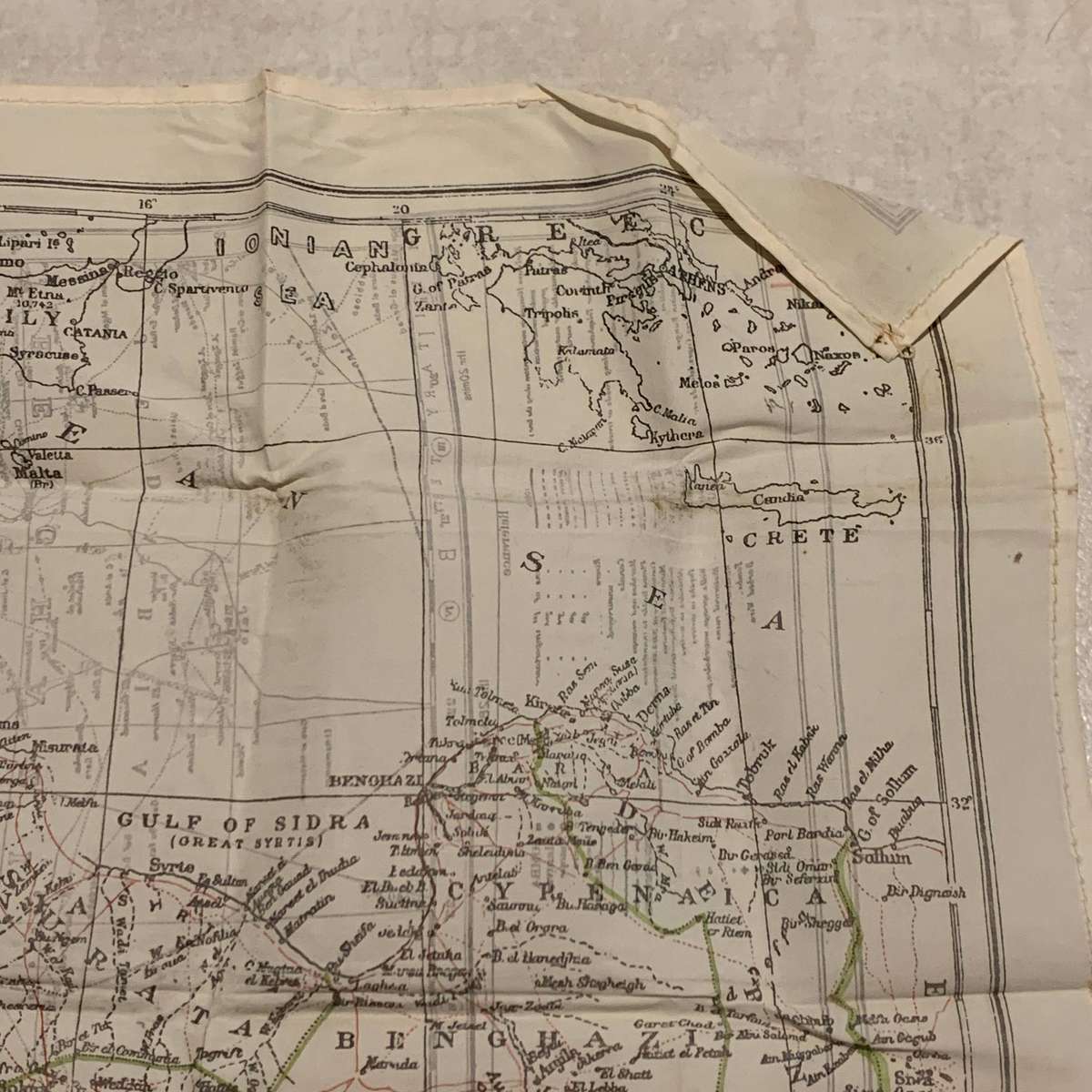
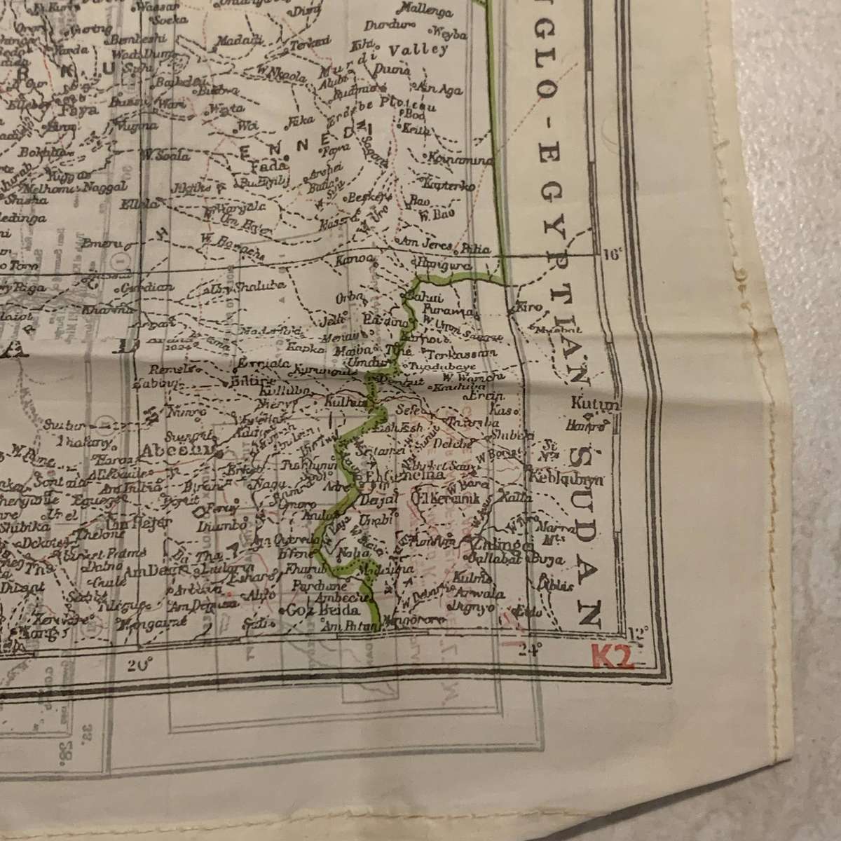
WW2 Silk 'N/Africa - Cyrenaica' Escape Map (K1/K2)
This original, early WW2 Allied pilots silk escape map covers North Africa and Cyrenaica, grids K1 and K2 and other than a couple of small holes and minor staining in places, it's in good condition with fold lines. It measures 52cm x 47cm.
NOTE: Escape maps were designed to aid downed aviators and allied serviceman in hostile territory during WW2 to help them escape from behind enemy lines. Silk material was used for survival maps because of its durability with weather, it didn't tear easily, it's incredibly light and can be folded tightly and easily hidden, it's silent when handled, unlike unfolding paper and it's waterproof and flexible when used in wet conditions.
Please feel free to email me with any queries, and please look closely at the pictures provided as they are of the actual item and form a vital part of the description.
To view our other listings, click Here.