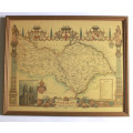
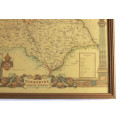
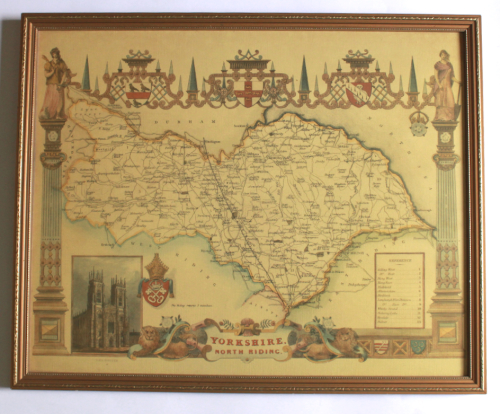
Yorkshire North Riding Map 1840`s By Thomas Moule Framed Print.
Secondhand
Shipping
Standard courier shipping from R30
R30 Standard shipping using one of our trusted couriers applies to most areas in South Africa. Some areas may attract a R30 surcharge. This will be calculated at checkout if applicable.
Check my rate
Check my rate
Free collection from
Kuils River, Cape Town
The seller allows collection for this item and will be in contact with the full collection address once the order is ready.
Ready for collection by Thursday, 30 May.
Ready to ship in
The seller has indicated that they will usually have this item
ready to ship within 3 business days. Shipping time depends on your delivery address. The most
accurate delivery time will be calculated at checkout, but in
general, the following shipping times apply:
Standard Delivery
| Main centres: | 1-3 business days |
| Regional areas: | 3-4 business days |
| Remote areas: | 3-5 business days |
Returns
Get it now, pay later
Seller
Buyer Protection
Product details
Condition
Secondhand
Location
South Africa
Area
Europe
Time Period
1800s
Type
Political Map
Bob Shop ID
614447338
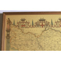
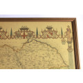
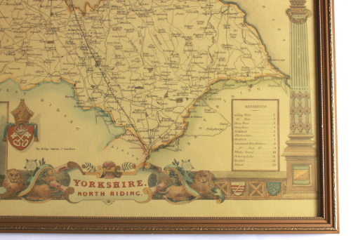
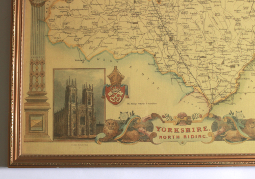
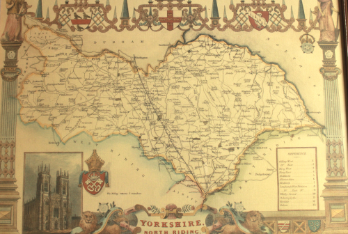
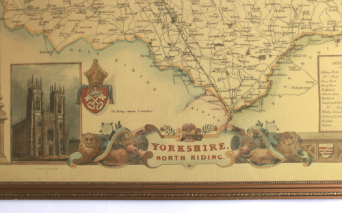
Title: Yorkshire North Riding Map 1840's By Thomas Moule Framed Print.
Cartographer: Thomas Moule.
Format: Colour Print in Frame with Glass.
Height: 43cm.
Width: 53cm.
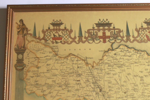
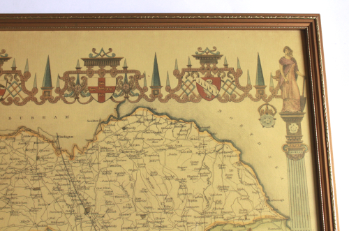
Info: A decorative and detailed early 19th century map of the North Riding of Yorkshire, with heraldic shields and an inset view of York Minister, which was produced by Thomas Moule and published in Barclay's Complete & Universal English Dictionary (London: George Virtue, 1841).
The County Returns 2 Members.
The Moule county maps were unusual for the period in that they were highly decorative. The scientific rationality of the late 18th & early 19th century had seen a move away from the flamboyance of earlier map making, emphasizing instead, a greater desire for accuracy and detail. Thomas Moule, like many of his contemporaries, however, was drawn to a more simplistic, pre-industrial age. This was clearly reflected in his maps with their neo-Gothic borders, heraldic shields and views of ancient buildings; ironically, the Moule maps issued later in the 1840s were amongst the first to show the newly constructed railways.
Reproduction Print circa 1980's on vintage style textured paper.
Scale: Unknown
Condition: Very Good, no foxing or browning on the map, the colours and detail are very good.
Price: R 545.00 Inc Vat.
![]()