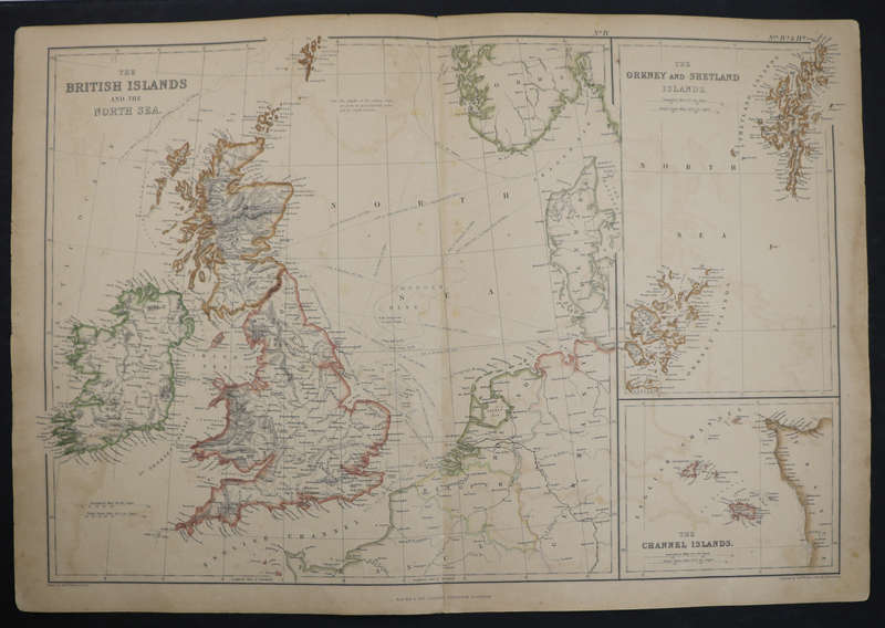


1859 The British Islands And The North Sea, The Orkney And Shetland Islands and The Channel Islands
1 available / secondhand
Want to pay less?
Shipping
This product qualifies for free shipping in South Africa, using one of our trusted couriers. Offers below R1,000.00 do not qualify for free shipping.
Check my rate
Check my rate
Free collection is available from various lockers and counter collection points across South Africa. Offers below R1,000.00 do not qualify for free shipping.
View locations
View locations
The seller has indicated that they will usually have this item
ready to ship within 4 business days.
Shipping time depends on your delivery address.
The most accurate delivery time will be calculated at checkout,
but in general, the following shipping times apply:
Standard Delivery
| Main centres: | 1-3 business days |
| Regional areas: | 3-4 business days |
| Remote areas: | 3-5 business days |
Seller
Buyer protection
Returns
Get it now, pay later