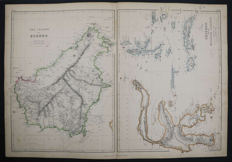
1859 The Islands Of Borneo and Celebes, And the Molucca Islands Map by Edward Weller 1859 The Islands Of Borneo and Celebes, And the Molucca Islands Map by Edward Weller

1859 The Islands Of Borneo and Celebes, And the Molucca Islands Map by Edward Weller

1 available / secondhand
R4,999.99
Want to pay less?
Shipping
R35.00 Standard shipping using one of our trusted couriers applies to most areas in South Africa. Some areas may attract a R30.00 surcharge. This will be calculated at checkout if applicable.
Check my rate
There are various locker and counter collection points across South Africa.
View locations
The seller allows collection for this item. Buyers will receive the collection address and time once the order is ready.
The seller has indicated that they will usually have this item ready to ship within 4 business days. Shipping time depends on your delivery address. The most accurate delivery time will be calculated at checkout, but in general, the following shipping times apply:
 
Standard Delivery
Main centres:  1-3 business days
Regional areas: 3-4 business days
Remote areas: 3-5 business days
Seller
Buyer protection
Returns
Warranty Type: Dealer Item Guaranteed as per Listing Description and Images Money-Back Guarantee: 7 Days: Dealer Guarantee: If you are not satisfied with your item(s), you may return the item(s) within 7 days of receiving them for a full refund of the sales price (return postage costs for buyers account) without leaving neutral or negative feedback.
Get it now, pay later

Product details

Condition
Secondhand
Location
South Africa
Time Period
1800s
Type
Physical Map
Product code
Map010
Bob Shop ID
642837162

1859 The Islands Of Borneo and Celebes, And the Molucca Islands Map by Edward Weller 

Size: 54,5cm x 37cm

Photos are of the actual item you will receive, please judge condition for yourself.

Please note that the photos were taken with a high qualify camera, the photos are 15mb each, unfortunately the website compresses the size of them thus reducing the quality. 

All maps have been photographed on a black canvas backing to allow for any defects to be visible 

Add to cart

Recently viewed

See more
Free shipping
4% OFF
Microsoft Surface Arc Bluetooth Mouse Light Grey FHD-00086
R2,700.00 R2,800.00
Ciskei - 1986 5th Anniversary of Independence FDC 1.20
R5.00
10% OFF
ATE Rear Brake Pads For Audi A8 A8 Quattro D3 3.0 Tdi 2002-2010
R929.00 R1,029.00
The Cure : The Head on the door
R1,100.00 No bids

Similar products

1859 The British Islands And The North Sea, The Orkney And Shetland Islands and The Channel Islands
R4,999.99
1859 North West Germany Map by Edward Weller- Has a tear in the bottom and top middle
R4,899.99
1859 Persia, Afghanistan And Beloochistan Map by Edward Weller- Has a slight tear in the bottom midd
R4,999.99
1859 Turkestan Or Independent Tartary Map by Edward Weller
R4,999.99