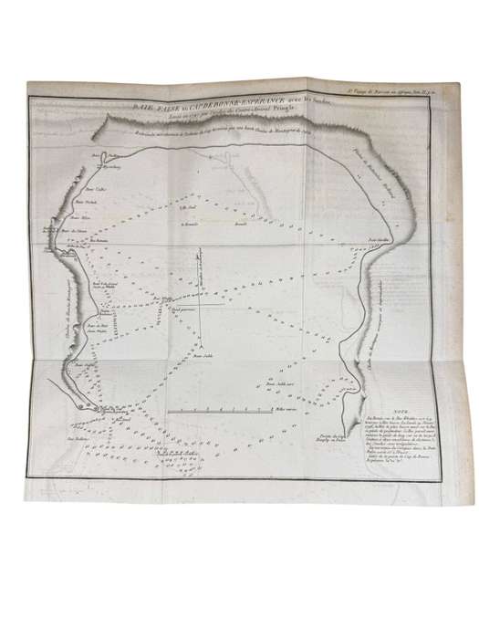
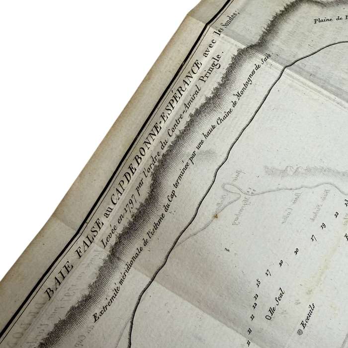
Antique Map Of FALSE BAY AT CAPE OF GOOD HOPE (Published 1806) Size: 27.5cm x 26cm Antique Map Of FALSE BAY AT CAPE OF GOOD HOPE (Published 1806) Size: 27.5cm x 26cm Antique Map Of FALSE BAY AT CAPE OF GOOD HOPE (Published 1806) Size: 27.5cm x 26cm Antique Map Of FALSE BAY AT CAPE OF GOOD HOPE (Published 1806) Size: 27.5cm x 26cm

Antique Map Of FALSE BAY AT CAPE OF GOOD HOPE (Published 1806) Size: 27.5cm x 26cm

Secondhand 1 available
R4,000.00
Shipping
R35.00 Standard shipping using one of our trusted couriers applies to most areas in South Africa. Some areas may attract a R30.00 surcharge. This will be calculated at checkout if applicable.
Check my rate
The seller allows collection for this item. Buyers will receive the collection address and time once the order is ready.
The seller has indicated that they will usually have this item ready to ship within 3 business days. Shipping time depends on your delivery address. The most accurate delivery time will be calculated at checkout, but in general, the following shipping times apply:
 
Standard Delivery
Main centres:  1-3 business days
Regional areas: 3-4 business days
Remote areas: 3-5 business days
Seller
Buyer protection
Get it now, pay later

Product details

Condition
Secondhand
Location
South Africa
Area
Africa
Time Period
1800s
Bob Shop ID
654050127

(From Nouveau Voyage dans la Partie Méridionale de lAfrique by John Barrow, Paris: Dentu, 1806)


A coastal chart of False Bay, showing its significance as a natural harbour. Published in the 1806 French edition of John Barrows Cape voyage.

         Original antique map (not a reproduction)

         Date: 1806

         Size: 27.5 × 26 cm

         Folding as issued in the book


Collectible for Cape maritime and naval history.


Terms and Conditions:

The provided photographs form an integral part of the item description.

Buyers are expected to assess the item's condition based on the images supplied.

All items are sold strictly "as is". Descriptions reflect our best efforts, but no guarantees are implied.

No returns or refunds will be accepted once the auction or Buy-Now option has concluded.

Payment is required within 24 hours of the listing's conclusion. Multiple payment methods are accepted.

Please use the Q&A section for any enquiries prior to purchase.

We encourage all buyers to conduct their own research and bid responsibly.

We wish you every success in acquiring this item.

Add to cart

Recently viewed

See more
Blue Car Rear Storage Box Organizer Box Storage Box for Dolphin Mini / for Seagull
New
R402.00
The Brood (Blu-ray)
New
R535.00
6% OFF
Battery for Lenovo ThinkPad X13-G1, L390, X390 Series (L18C6PD1)
New
R1,499.00 R1,599.00
2x 64316945596 Recirculating Cabin Air Filter for Bmw E70 X5 X6
New
R366.00

Similar products

Antique Map Of PLETTENBERG BAY (Published 1806) Size: 28cm x 23cm
Secondhand
R4,000.00
Free shipping
Antique Carta Geografica Del Regno Di Corsica Framed Map (Plate) Published by Giambattista Abrizzi
Secondhand
R1,750.00
56% OFF
1795 original antique map of the Cape of Good Hope
Secondhand
R7,500.00 R17,200.00
Rhodesiana - copper pressed framed map (22,5 x 27cm)
Secondhand
R195.00