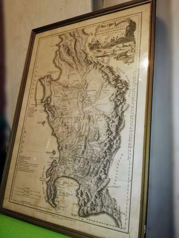
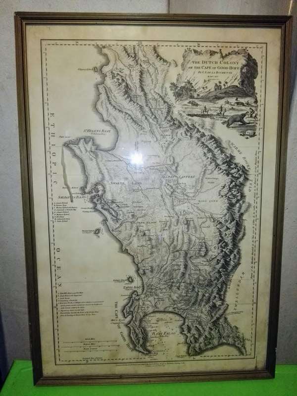
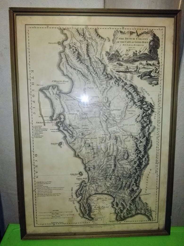
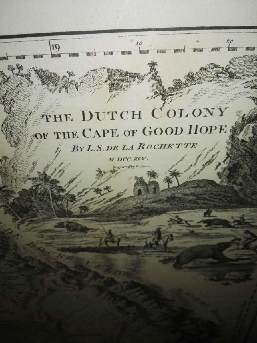
[ Cape of Good Hope / Cape Town, South Africa ] The Dutch Colony of the Cape of Good Hope by L.S. De La Rochette MDCC XCV
-Publication place/Date: London / 1795
-Image Dimensions: 13 x 20 inches
-Color: Uncolored
Faden's Detailed Map of the Cape Town Region
Second edition of this highly detailed map of the Dutch Colony on the Cape of Good Hope, first published in 1782.
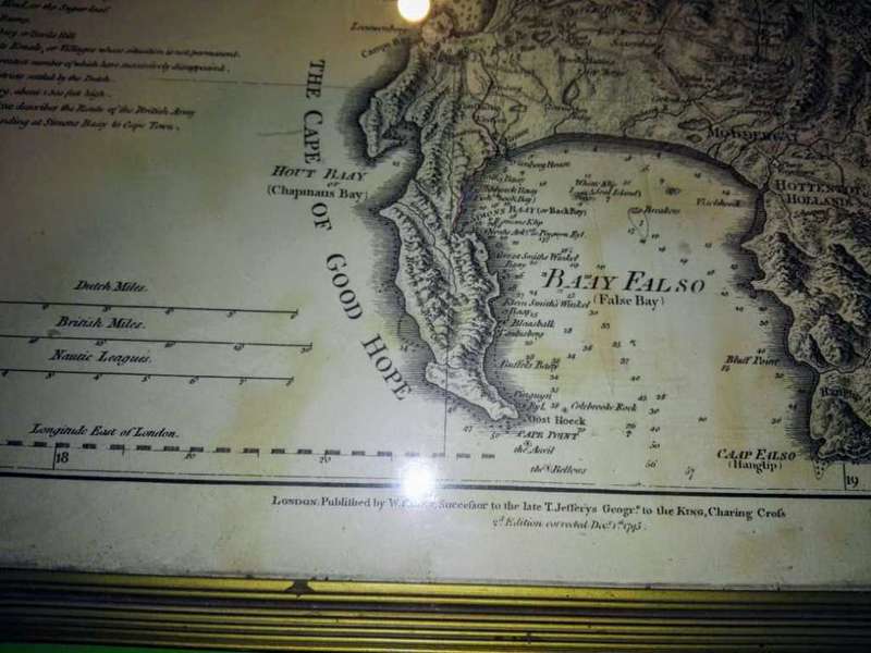
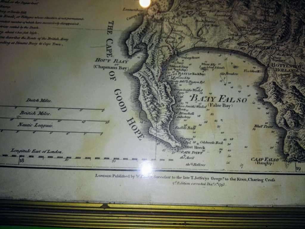
The map is particularly rich in detail and scope, stretching from "Klipping Eyland" to "Cape Falso". The addition of "Muyzenberg about 1300 feet high" in the second edition suggests an ongoing exploration and more profound knowledge of the region's topography during that period. The map labels approximately twenty farms and settlements, some of which were significant like Constantia and Stellenbosch. The geographical boundary of the Dutch colony is indicated by the imposing Drakenstein mountains to the east of the Cape.
The cartouchea cliff bearing the titlefeatures picturesque palms, thatched huts, and a majestic elephant, indicative of the local fauna, in the foreground. Its purpose is not merely decorative, as it provides a glimpse into the life and environment of the indigenous people during the colonial period.
A five point key identifies important areas on the map.
- Point 'a' references "Table Hill about 3,400 Feet High", a significant landmark that dominates the local landscape. This flat-topped mountain, known today as Table Mountain, overlooks the city of Cape Town and provides a stunning backdrop to the bustling port below.
- Following this, point 'b' denotes "Lion's Head, or the Sugarloaf", another prominent peak located nearby. Together with point 'c', "Lion's Rump", these landmarks create a distinctive silhouette visible from miles away, guiding sailors into the sheltered bay below.
- Point 'd' presents "Duivelsberg.or Devils Hill", yet another topographical feature of the region. It is a stark reminder of the rugged and unforgiving nature of the local terrain that the settlers had to navigate and adapt to.
- The key also shows small huts for "Hottentots Kraals, or Villages". These temporary settlements, which belonged to the Khoisan people, were typically constructed using local materials and designed to be moved as required. However, their prevalence waned as Dutch settlements expanded, leading to the displacement of the indigenous communities.
- Point 'e' reintroduces "Muyzenberg, about 1,300 feet high". The mountain is an important feature of the False Bay coastline, a region known for its breathtaking landscapes.
In the 17th and 18th centuries, the Cape of Good Hope was a crucial way station for the Dutch East India Company (VOC) en route from Europe to the East Indies. Established in 1652 by Jan van Riebeeck, the colony was initially intended to provide fresh produce to prevent scurvy among sailors during their long voyages. The settlement at the Cape quickly evolved, growing to include a more permanent population and becoming a vital trading post for the VOC.
By the late 18th century, the time of the map's publication, the Cape Colony was a well-established, if not somewhat isolated, outpost of the Dutch Empire. The local population was a mixture of Dutch settlers, indigenous Khoisan people, slaves from Southeast Asia and East Africa, and a growing community of freed slaves and mixed-race individuals known as the Cape Coloureds.
The map, therefore, is more than a geographical representation; it is a historical artifact, providing a window into a pivotal moment in the Cape Colony's development, as it transitioned from a small provisioning station to a diverse, multicultural settlement on the brink of major geopolitical shifts.
Reference :
Norwich Map # 225. Tooley, Guide to Maps of Africa, p. 40, plate 30. Map Collectors Circle # 61, Map 126, p. 17 plate VII.
.jpg)
.jpg)

.jpg)
.jpg)
.jpg)
.jpg)

.jpg)

.jpg)
.jpg)
.jpg)
.jpg)
.jpg)