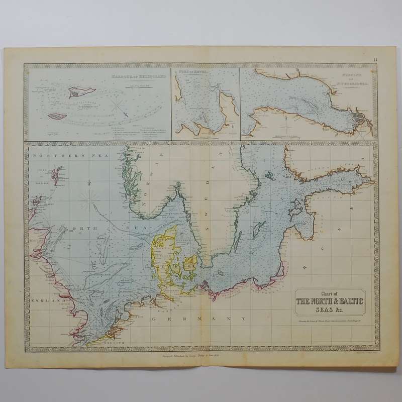
Chart of the North & Baltic Seas &c. -

Chart of the North & Baltic Seas &c. -

1 available / new
Only 1 left – grab it before it’s gone!
R1,830.00
Shipping
R35.00 Standard shipping using one of our trusted couriers applies to most areas in South Africa. Some areas may attract a R30.00 surcharge. This will be calculated at checkout if applicable.
Check my rate
The seller has indicated that they will usually have this item ready to ship within 3 business days. Shipping time depends on your delivery address. The most accurate delivery time will be calculated at checkout, but in general, the following shipping times apply:
 
Standard Delivery
Main centres:  1-3 business days
Regional areas: 3-4 business days
Remote areas: 3-5 business days
Seller
Buyer protection
Get it now, pay later

Product details

Condition
New
Location
South Africa
Product code
301539
Bob Shop ID
591470710

Showing the lines of steam boat communications, soundings and &c.

Large hand-coloured steel engraved map. Good condition with clear unfaded colour. With insets of Harbour of Heligoland, Port Revel and Harbour of St Petersburg. Margins frayed, some age toning and a central fold. Engraved by Gellatly, Edinburgh. Sheet size: 454cm x 665cm

Publisher: George Philip & Son
Date Published: 1851
Publication Place: Liverpool
First Edition: Yes

Condition: Good

Dimensions: Sheet size: 454cm x 665cm

Add to cart

Recently viewed

See more
Free shipping
1% OFF
Lenovo ThinkSmart Core for Logitech 11RXS00090V
R27,000.00 R27,300.00
Wirewound axial inductor 0.18uh 0a89 0e07 0.89a ec36-r18m
R1.36
1987 - RSA Rock paintings - Maximum Cards
R5.00
Guide Bolt Kit - Abc245 (Argus Motoring)
R619.00

Similar products

The Sea Of Tranquility
R119.00
Chart of the Mediterranean showing Steam Communication Lines -
R2,030.00
Antarctica - No Single Country, No Single Sea - Bond, C. & Siegfried, R. & Johnson, Peter
R310.00
Caterpillar Seas: A True Story
R75.00