This is a digital product (eg. voucher, product license, service, etc.) and does not require shipping.
The seller will be in contact to deliver this product to you electronically.
The seller has indicated that they will usually have this item
ready to ship within 3 business days.
Shipping time depends on your delivery address.
The most accurate delivery time will be calculated at checkout,
but in general, the following shipping times apply:
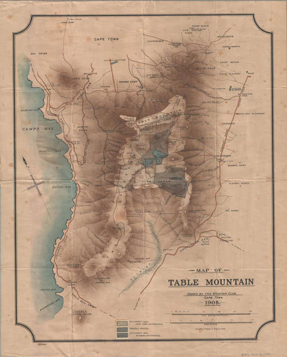
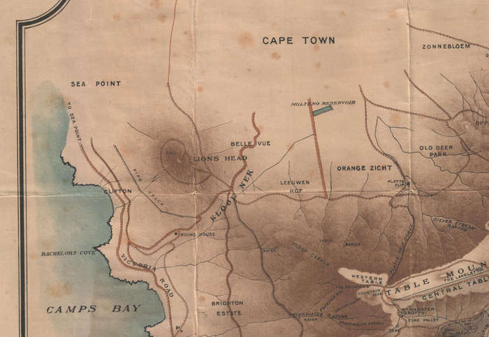
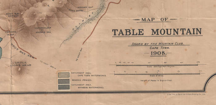
Title: Digital Map Table Mountain 1908 Digital Download. Publisher: The Mountain Club of South Africa Cape Town. Format: Vintage Printed Maps that have been scanned and saved as Tiff images. File Size: Total of 6.4MB. Scale: 1 Inch = 2000 Cape Feet. Print To A3 / A2 Size. Info: A vintage map of the Mountain by The Mountain Club of South Africa issued in 1908. Lithographed by Van der Sandt de Villiers Printing Company, Ltd., Topographical map of the Table Mountain area including the coastline from Sea Point to Kommetje's Bay [Kommetjie]. The map shows detailed features of Table Mountain including the Central Table, Back Table, Orange Kloof, Victorskloof or Kronen Dal and Modder Gat. It also indicates the location of the major water sources on the mountain including the Woodhead Reservoir, the Hely Hutchinson Reservoir and the Wynberg Reservoirs, as well as the Molteno Dam and the Newlands Reservoir at the foot of the mountain on its north and east flanks. It also shows the Wynberg Disa Stream, the Palmiet River, Camp's Bay Tram station and the route of the Camp's Bay tramline. Other peaks and ridges depicted are the Twelve Apostles, Little Lion's Head, Klaasen Kop and Constantia Nek. The key indicates (a) the Catchment area, Cape Town Waterworks, (b) the Catchment area, Wynberg Waterworks and (c) the Reserve (fenced). Also shown are heights of peaks in English feet. Format: Digital files transferred via WeTransfer - A download Link will be forwarded on completion of order. Price: R 245.00 Inc Vat.