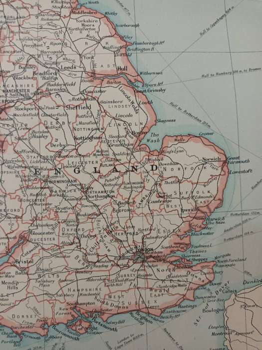


Map: British Isles Political
Check my rate
| Main centres: | 1-3 business days |
| Regional areas: | 3-4 business days |
| Remote areas: | 3-5 business days |


| Main centres: | 1-3 business days |
| Regional areas: | 3-4 business days |
| Remote areas: | 3-5 business days |
Map: 'British Isles - Political', 1924.
Central fold. In very good condition.
In 1924, when this map was printed, the political situation in the British Isles was marked by significant change and instability. The United Kingdom experienced its first Labour government under Prime Minister Ramsay MacDonald, although it was a minority administration dependent on Liberal support and lasted only from January to October. MacDonald's government introduced progressive reforms but faced fierce opposition, especially over foreign policy and accusations of communist sympathies, culminating in the controversial "Zinoviev Letter" scandal that helped bring down the government. After Labours fall, the Conservatives, led by Stanley Baldwin, returned to power. Meanwhile, the Irish Free State, established in 1922 following the Anglo-Irish Treaty, was solidifying its independence from Britain, although tensions remained, particularly with Northern Ireland, which remained part of the UK under its own devolved government. The year reflected broader post-WWI political shifts, with rising Labour influence, lingering imperial concerns, and growing challenges to traditional Conservative-Liberal dominance.
Large sheet, measuring 45 x 36 cm, including narrow margins.
Extracted from The Citizen's Atlas of the World, published in Edinburgh by John Bartholemew & Son, in 1924.
A real time capsule from the early post-World-War-One period.
Framed, this sheet would look great in a study or man-cave. It could be personalized with some vintage travel ephemera, such as baggage labels, train tickets, etc.