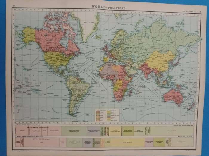


Map: World - Political, 1924
Check my rate
| Main centres: | 1-3 business days |
| Regional areas: | 3-4 business days |
| Remote areas: | 3-5 business days |


| Main centres: | 1-3 business days |
| Regional areas: | 3-4 business days |
| Remote areas: | 3-5 business days |
Political map of the world, 1924
Showing the British Empire at its height (areas in red).
Central fold. Tear without loss on the fold. In very good condition.
In 1924, when this map was published, the world was navigating the complex aftermath of World War I, with political and economic instability defining much of the global landscape. Europe was marked by recovery efforts and political upheaval: Germany faced hyperinflation and political unrest under the Weimar Republic, although the Dawes Plan that year sought to stabilize its economy and reparations payments. The Soviet Union, under Lenins successor Joseph Stalin, was consolidating power and pushing forward with centralization. In Italy, Mussolini's fascist regime was solidifying its grip, while other democracies struggled with rising extremism. The United States, largely isolationist, was experiencing economic prosperity during the Roaring Twenties, asserting growing financial influence globally. Meanwhile, colonial empires, particularly Britain and France, maintained control over vast territories, though nationalist movements were beginning to stir across Asia and Africa. The global economy remained fragile, interdependent, and susceptible to shifts in diplomacy, reparations policies, and the fluctuating postwar markets.
Large sheet, measuring 45 x 36 cm, including narrow margins.
Extracted from The Citizen's Atlas of the World, published in Edinburgh by John Bartholemew & Son, in 1924.
A real time capsule from the early post-World-War-One period.
Framed, this sheet would look great in a study or man-cave. It could be personalized with some vintage travel ephemera, such as baggage labels, train tickets, etc.