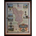
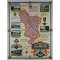
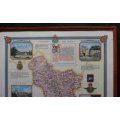
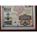
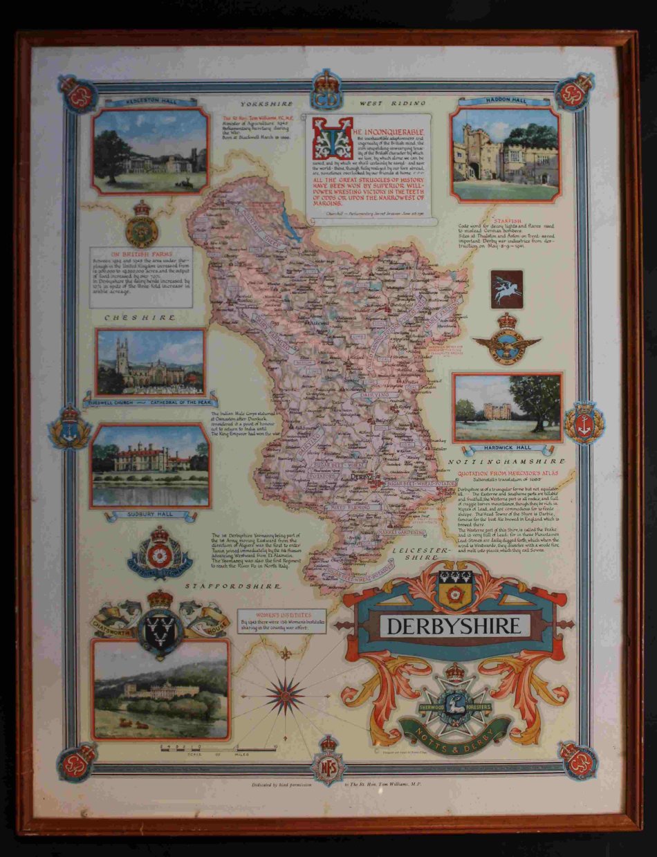
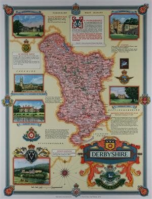
Map of Derbyshire by Ernest Clegg 1946
Secondhand
Shipping
Standard courier shipping from R30
R30 Standard shipping using one of our trusted couriers applies to most areas in South Africa. Some areas may attract a R30 surcharge. This will be calculated at checkout if applicable.
Check my rate
Check my rate
Free collection from
Kuils River, Cape Town
The seller allows collection for this item and will be in contact with the full collection address once the order is ready.
Ready for collection by Wednesday, 22 May.
Ready to ship in
The seller has indicated that they will usually have this item
ready to ship within 3 business days. Shipping time depends on your delivery address. The most
accurate delivery time will be calculated at checkout, but in
general, the following shipping times apply:
Standard Delivery
| Main centres: | 1-3 business days |
| Regional areas: | 3-4 business days |
| Remote areas: | 3-5 business days |
Returns
Get it now, pay later
Seller
Buyer Protection
Product details
Condition
Secondhand
Location
South Africa
Area
Europe
Time Period
1900-1950
Type
Political Map
Bob Shop ID
614449147
Title: Map of Derbyshire by Ernest Clegg 1946.
By: Designed and drawn By Ernest Clegg.
Devised By: Donald McCullough.
Format: Framed Map.
Printed by John Waddington Ltd Leeds England 1946.
County map. Rare chromolithographed map celebrating the victory of the Allies. Original colour.
A map of Derbyshire from the The Countryman County Maps of Britain
Devised by Donald McCullough and designed and drawn by Ernest Clegg.
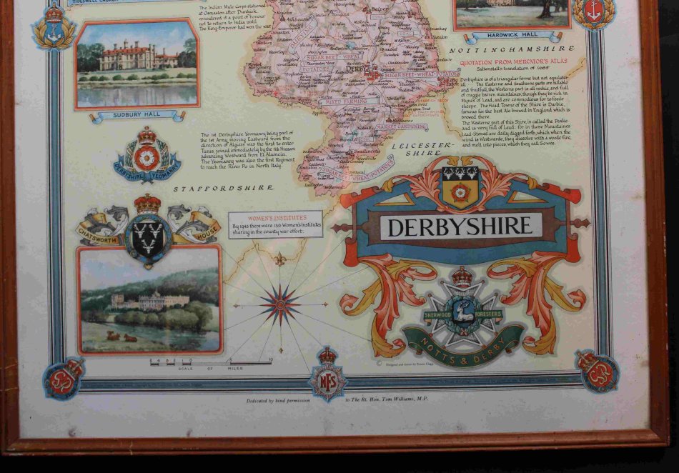
Full colour litho with decorative vignettes of Kedleston Hall, Tidswell Church, Sudbury Hall, Chatsworth House, Haddon Hall & Hardwick House.
Explanatory and patriotic text with a quotation from Churchill & Mercators Atlas.
Dedicated to Rt.Hon.Tom Williams M.P
Size: 57cm x 44cm.
Condition: Very Good.
Price R 995.00 Inc Vat.
![]()
![]()