Mitchell`s Map of New York and Brooklyn 1871 Digital Download Mitchell`s Map of New York and Brooklyn 1871 Digital Download Mitchell`s Map of New York and Brooklyn 1871 Digital Download Mitchell`s Map of New York and Brooklyn 1871 Digital Download Mitchell`s Map of New York and Brooklyn 1871 Digital Download Mitchell`s Map of New York and Brooklyn 1871 Digital Download Mitchell`s Map of New York and Brooklyn 1871 Digital Download
Mitchell`s Map of New York and Brooklyn 1871 Digital Download Mitchell`s Map of New York and Brooklyn 1871 Digital Download Mitchell`s Map of New York and Brooklyn 1871 Digital Download Mitchell`s Map of New York and Brooklyn 1871 Digital Download
Mitchell`s Map of New York and Brooklyn 1871 Digital Download
+3

Mitchell`s Map of New York and Brooklyn 1871 Digital Download

Digital product
New 1 available
Only 1 left – grab it before it’s gone!
R295.00
Shipping
This is a digital product (eg. voucher, product license, service, etc.) and does not require shipping. The seller will be in contact to deliver this product to you electronically.
The seller has indicated that they will usually have this item ready to ship within 3 business days. Shipping time depends on your delivery address. The most accurate delivery time will be calculated at checkout, but in general, the following shipping times apply:
 
Standard Delivery
Main centres:  1-3 business days
Regional areas: 3-4 business days
Remote areas: 3-5 business days
Seller
Buyer protection
Get it now, pay later

Product details

Condition
New
Location
South Africa
Area
The Americas
Time Period
1800s
Type
Road Map
Product code
8325327
Bob Shop ID
629708072

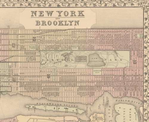
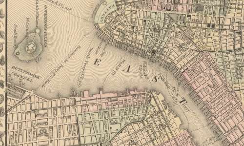
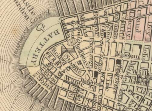
Title: Mitchell's Map of New York and Brooklyn 1871 Digital Download.
Map By: Samuel A Mitchell.
Publisher: Mitchell's New General Atlas, Philadelphia 1871.
Year Published: 1871.
File Type and Size:  TIF File 45MB and JPG 9MB File Images.
Printed Size: Can be printed in in A3 or A2 Size.
Info: A detailed Map of New York and Brooklyn with an inset of the Northern Portion of New York City and County.
"Entered according to act of Congress in the year 1871 by S Augustus Mitchell in the Office of the Librarian of Congress at Washington."
Includes street names and suburbs with waterways ferry information.
With a floral design around the border.
Condition: Digital Download.
Price: R 295.00 Inc Vat.


Add to cart

Recently viewed

See more
29% OFF
CBI Circuit Breaker 1 Pole Curve 2 15A 6kA 240V QFA18215
New
R139.00 R195.00
53% OFF
Everyman and Medieval Miracle Plays - A.C.Cowley
Secondhand
R70.00 R150.00
PS2 Pitfall The Lost Expedition
Secondhand
R1,999.00 No bids
Bop - 1984 History of the Telephone (4th Series) - Full Set of Controls - MNH
Secondhand
R6.00

Similar products

Bains Railways Map of South Africa Digital Map Download
Secondhand
R295.00
Northern Rhodesia Digital Map Digital Download
New
R195.00
North West Provincial Map - Digital Download
New
R120.00
Deutsche-Sudwesafrika 1913 Map Digital Map Digital Download
New
R295.00