National Geographic Folded Map of The United States Of America June 1951 National Geographic Folded Map of The United States Of America June 1951 National Geographic Folded Map of The United States Of America June 1951 National Geographic Folded Map of The United States Of America June 1951 National Geographic Folded Map of The United States Of America June 1951 National Geographic Folded Map of The United States Of America June 1951 National Geographic Folded Map of The United States Of America June 1951 National Geographic Folded Map of The United States Of America June 1951 National Geographic Folded Map of The United States Of America June 1951 National Geographic Folded Map of The United States Of America June 1951 National Geographic Folded Map of The United States Of America June 1951 National Geographic Folded Map of The United States Of America June 1951 National Geographic Folded Map of The United States Of America June 1951
National Geographic Folded Map of The United States Of America June 1951 National Geographic Folded Map of The United States Of America June 1951 National Geographic Folded Map of The United States Of America June 1951 National Geographic Folded Map of The United States Of America June 1951
National Geographic Folded Map of The United States Of America June 1951
+9

National Geographic Folded Map of The United States Of America June 1951

Secondhand 1 available
R345.00
Shipping
Free shipping is available from CapeCollectables for all orders above R1,500.00, using one of our trusted couriers.
Check my rate
The seller allows collection for this item. Buyers will receive the collection address and time once the order is ready.
The seller has indicated that they will usually have this item ready to ship within 3 business days. Shipping time depends on your delivery address. The most accurate delivery time will be calculated at checkout, but in general, the following shipping times apply:
 
Standard Delivery
Main centres:  1-3 business days
Regional areas: 3-4 business days
Remote areas: 3-5 business days
Seller
Buyer protection
Get it now, pay later

Product details

Condition
Secondhand
Location
South Africa
Area
The Americas
Time Period
Post-1950
Type
Political Map
Product code
8325711
Bob Shop ID
629935079

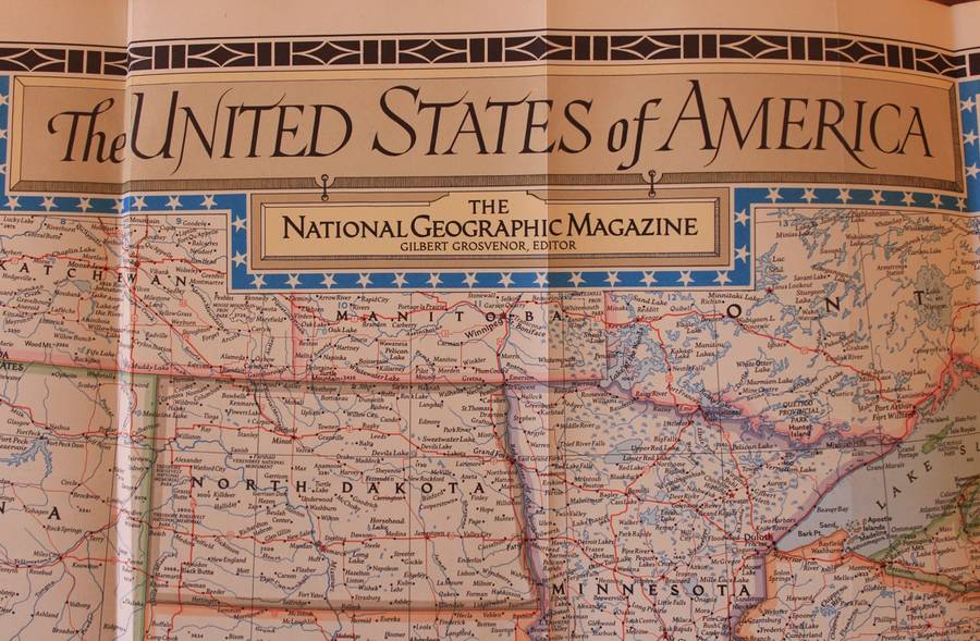
Title: National Geographic Folded Map of The United States Of America June 1951
Publisher: National Geographic Society, June 1951.
Format: Folded Map.
Height: 67cm.
Width:  103cm.
Scale: 1: 5 000 000  / 1 Inch = 78.91 Miles.
Info: A folded map of the USA in full from Coast to Coast and North to South, including insets of New York and East of Maine. Interestingly the map does not include Alaska or Hawaii.
The Reverse of the Map is blank.
Condition: Very Good, unmarked and unused, the left edge of the map has been trimmed to fit into the Book from 1951.
Price: R 345.00 Inc Vat.


Add to cart

Recently viewed

See more
2000 Deutschland MiNr 2094-2097 MNH
Secondhand
R48.00
Free shipping
50% OFF
3pcs Non-Stick Pan Set Aluminum 17.78 cm - 24.13 cm - 27.94 cm Grey Foa And Pfas-Free for Kitchen Co
New
R1,790.00 R3,580.00
Design House Watercolour Bird Cushion Cover (600 x 600mm)
New
R518.00
Gary Sieling - Organ Works Of Stanley Vann And Kenneth Leighton Memorial Album / Organ Of Chelmsf...
New
R379.00

Similar products

National Geographic Folded Map of Central America April 1986
Secondhand
R195.00
Vintage National Geographic Folded Map of Europe June 1969
Secondhand
R295.00
National Geographic Folded Map of Mexico and Central America June 2007
Secondhand
R195.00
National Geographic Folded Map of The South Western United States December 1948
Secondhand
R225.00