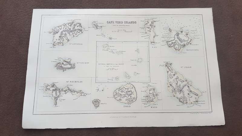
ORIGINAL 1856 MAP: Cape Verd Islands, From the Admiralty Survey ( Cape Verde Islands )

ORIGINAL 1856 MAP: Cape Verd Islands, From the Admiralty Survey ( Cape Verde Islands )

Secondhand 1 available
R695.00
Shipping
R35.00 Standard shipping using one of our trusted couriers applies to most areas in South Africa. Some areas may attract a R30.00 surcharge. This will be calculated at checkout if applicable.
Check my rate
The seller has indicated that they will usually have this item ready to ship within 3 business days. Shipping time depends on your delivery address. The most accurate delivery time will be calculated at checkout, but in general, the following shipping times apply:
 
Standard Delivery
Main centres:  1-3 business days
Regional areas: 3-4 business days
Remote areas: 3-5 business days
Seller
Buyer protection
Get it now, pay later

Product details

Condition
Secondhand
Location
South Africa
Area
Africa
Time Period
1800s
Type
Physical Map
Bob Shop ID
650811418

Publisher: London and Edinburgh, A. Fullarton and Co., 1856

About this Item

Map itself is in very clean attractive condition within border. Map is from a Gazzetteer of the World published in 1856 by Fullarton. Drawn and Engraved by J. Bartholomew of Edinburgh. The map itself is 23 cm x 14 cm withn the border, and sheet is 16.5 cm x 26 cm. Comprises 9 separate maps of the various islands and a General Sketch of the Group in their true position in the middle. Steel engraving with three lithographic colours: black outline, light blue, light brown. Would display beautifully.


Add to cart

Recently viewed

See more
6.00 x 4.00 mm Emerald cut Garnet 0.63 ct.
New
R279.00 No bids
Whiskey Ice Ball Maker Food Grade Reusable Silicone Ice Mold Tray Ice Cube Mold Kitchen with 5cm Bal
New
R395.00
D.J. U-Neek ft Gemini - Doctor Doctor CD Maxi Single Import
Secondhand
R79.00
Car Center Console Organizer Storage Box Interior Accessories Armrest Storage Box for 3008 4008 5008
New
R424.00

Similar products

Free shipping
1859 The Islands Of Borneo and Celebes, And the Molucca Islands Map by Edward Weller
Secondhand
R4,999.99
Digital Map of Robben Island from 1880's - 1894, Digital Download
New
R195.00
Island of Jamaica. Original 1856 map with three colour lithographic tints. By G.H. Swanston.
Secondhand
R395.00
1922 Map of South Africa - Western Half - Excellent Condition, Original Bartholomew Map Cape Town
Secondhand
R745.00