Vintage Folded Map of Britain and Northern Ireland for Tourists 1980 Vintage Folded Map of Britain and Northern Ireland for Tourists 1980 Vintage Folded Map of Britain and Northern Ireland for Tourists 1980 Vintage Folded Map of Britain and Northern Ireland for Tourists 1980 Vintage Folded Map of Britain and Northern Ireland for Tourists 1980 Vintage Folded Map of Britain and Northern Ireland for Tourists 1980 Vintage Folded Map of Britain and Northern Ireland for Tourists 1980 Vintage Folded Map of Britain and Northern Ireland for Tourists 1980 Vintage Folded Map of Britain and Northern Ireland for Tourists 1980 Vintage Folded Map of Britain and Northern Ireland for Tourists 1980
Vintage Folded Map of Britain and Northern Ireland for Tourists 1980 Vintage Folded Map of Britain and Northern Ireland for Tourists 1980 Vintage Folded Map of Britain and Northern Ireland for Tourists 1980 Vintage Folded Map of Britain and Northern Ireland for Tourists 1980
Vintage Folded Map of Britain and Northern Ireland for Tourists 1980
+6

Vintage Folded Map of Britain and Northern Ireland for Tourists 1980

1 available / secondhand
R195.00
Shipping
Free shipping is available from CapeCollectables for all orders above R1,500.00, using one of our trusted couriers.
Check my rate
The seller allows collection for this item. Buyers will receive the collection address and time once the order is ready.
The seller has indicated that they will usually have this item ready to ship within 3 business days. Shipping time depends on your delivery address. The most accurate delivery time will be calculated at checkout, but in general, the following shipping times apply:
 
Standard Delivery
Main centres:  1-3 business days
Regional areas: 3-4 business days
Remote areas: 3-5 business days
Seller
Buyer protection
Returns
Money-Back Guarantee: 7 Days: Excludes Cost Of Return Shipping
Get it now, pay later

Product details

Condition
Secondhand
Location
South Africa
Area
Europe
Time Period
Post-1950
Type
Road Map
Product code
8326800
Bob Shop ID
630989004

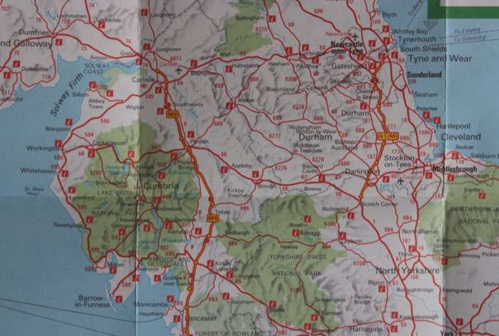
 Title: Vintage Folded Map of Britain and Northern Ireland for Tourists 1980.
Publisher: BTA British Tourist Authority 1980.
Printed By: George Philip & Son Ltd.
Format: Folded Map. Whole Country on 1 x side - reverse has information only.
Height: 84cm.
Width: 59cm.
Info: Information about roads and motoring with mileage charts, conversion tables and railway services. Roads around London map.
Includes Insets of the Channel Islands, Orkney and Shetland Islands.
Scale: 1: 1 250 000
Great Nostalgia Map - suitable for framing and displaying in the Bar area.
Condition: Good, the map has some pin holes and worn edges.
Price: R 195.00 Inc Vat.


Add to cart

Recently viewed

See more
54% OFF
Bloemfontein Celtic Supporters Tee Shirt - 2XL
R85.00 R185.00
Shuters top class life orientation : Grade 7 : Teacher's Book - LO-GR7
R187.00
THOR COMIC BOOK
R145.00
Large Glitter Tulle Fairy Wings for Adults ( elf wings, Pixie wings) for Halloween costume
R500.00

Similar products

VINTAGE TOURIST MAP OF BEIJING
R159.00
Two Vintage Folded AA Road Maps - Northern Cape 1995 and Kimberley 1993
R95.00
RHODESIA TOURIST MAP PRE-1980
R350.00
National Geographic Folded Map of the Northern Plains of the USA December 1986
R195.00