This item has closed 1 buyer bought 1 item
View other items offered by CapeCollectables1056

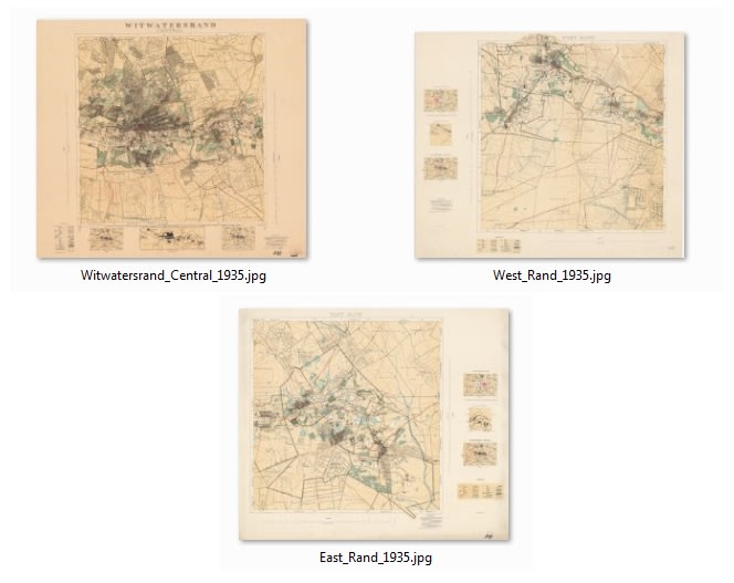
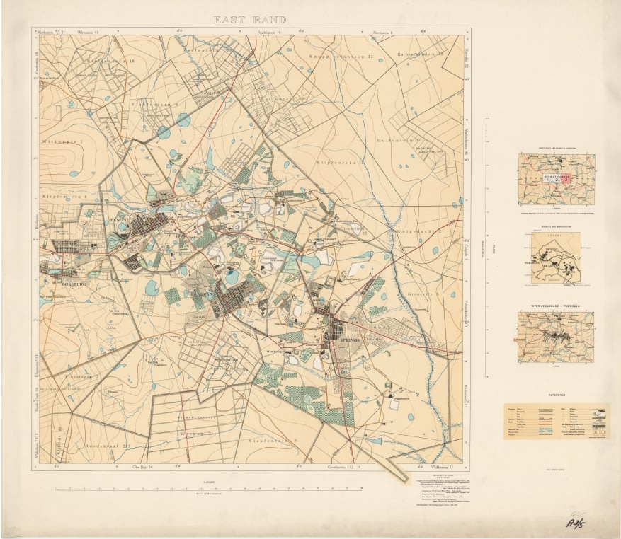
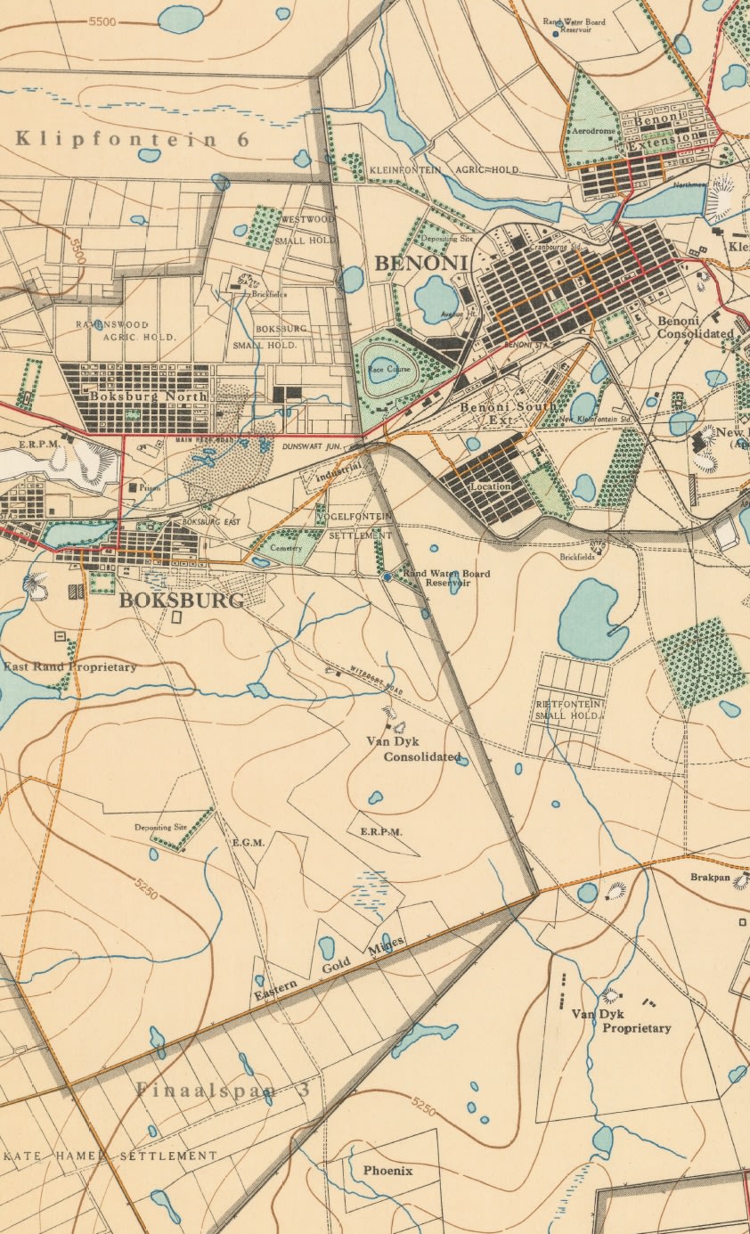
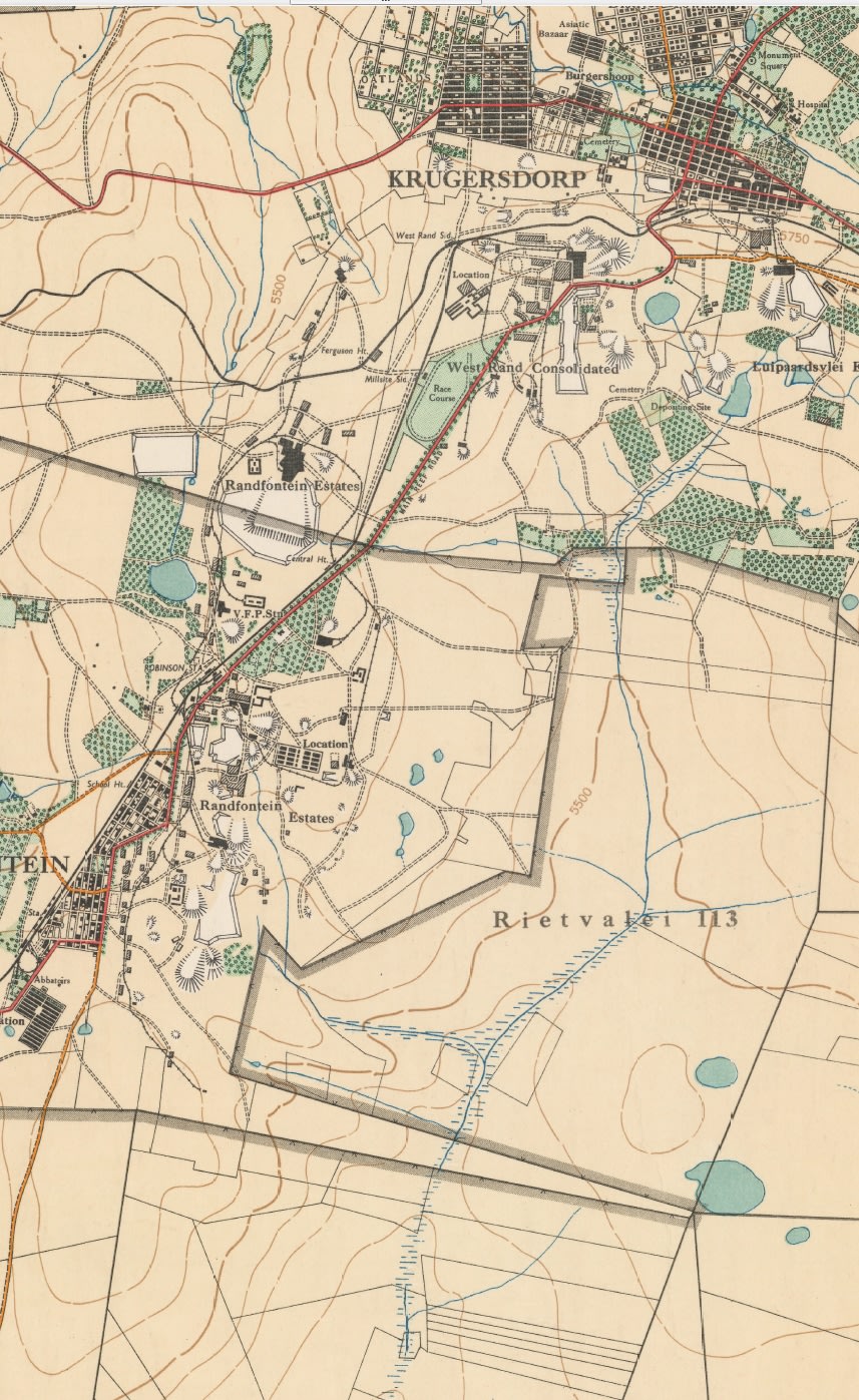
Witwatersrand Central, East and West; Topographical Map 1935, Set of 3 x Maps Digital Download.
New
R245.00
Closed
11 Jul 19 17:24
Shipping
Standard courier shipping from R30
R30 Standard shipping using one of our trusted couriers applies to most areas in South Africa. Some areas may attract a R30 surcharge. This will be calculated at checkout if applicable.
Check my rate
Check my rate
Free collection from
Somerset West, Cape Town
The seller allows collection for this item and will be in contact with the full collection address once the order is ready.
Ready for collection by Thursday, 20 June.
Ready to ship in
The seller has indicated that they will usually have this item
ready to ship within 3 business days. Shipping time depends on your delivery address. The most
accurate delivery time will be calculated at checkout, but in
general, the following shipping times apply:
Standard Delivery
| Main centres: | 1-3 business days |
| Regional areas: | 3-4 business days |
| Remote areas: | 3-5 business days |
Returns
Get it now, pay later
Seller
Buyer Protection
Product details
Condition
New
Location
South Africa
Area
Africa
Time Period
1900-1950
Type
Political Map
Bob Shop ID
420586792
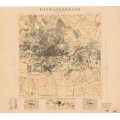
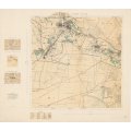
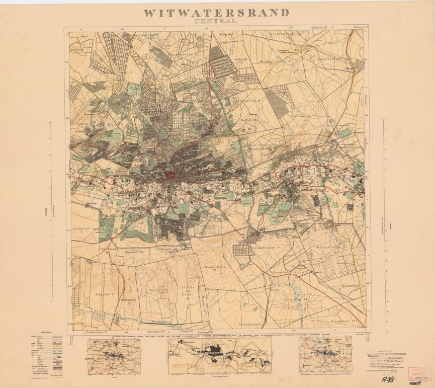
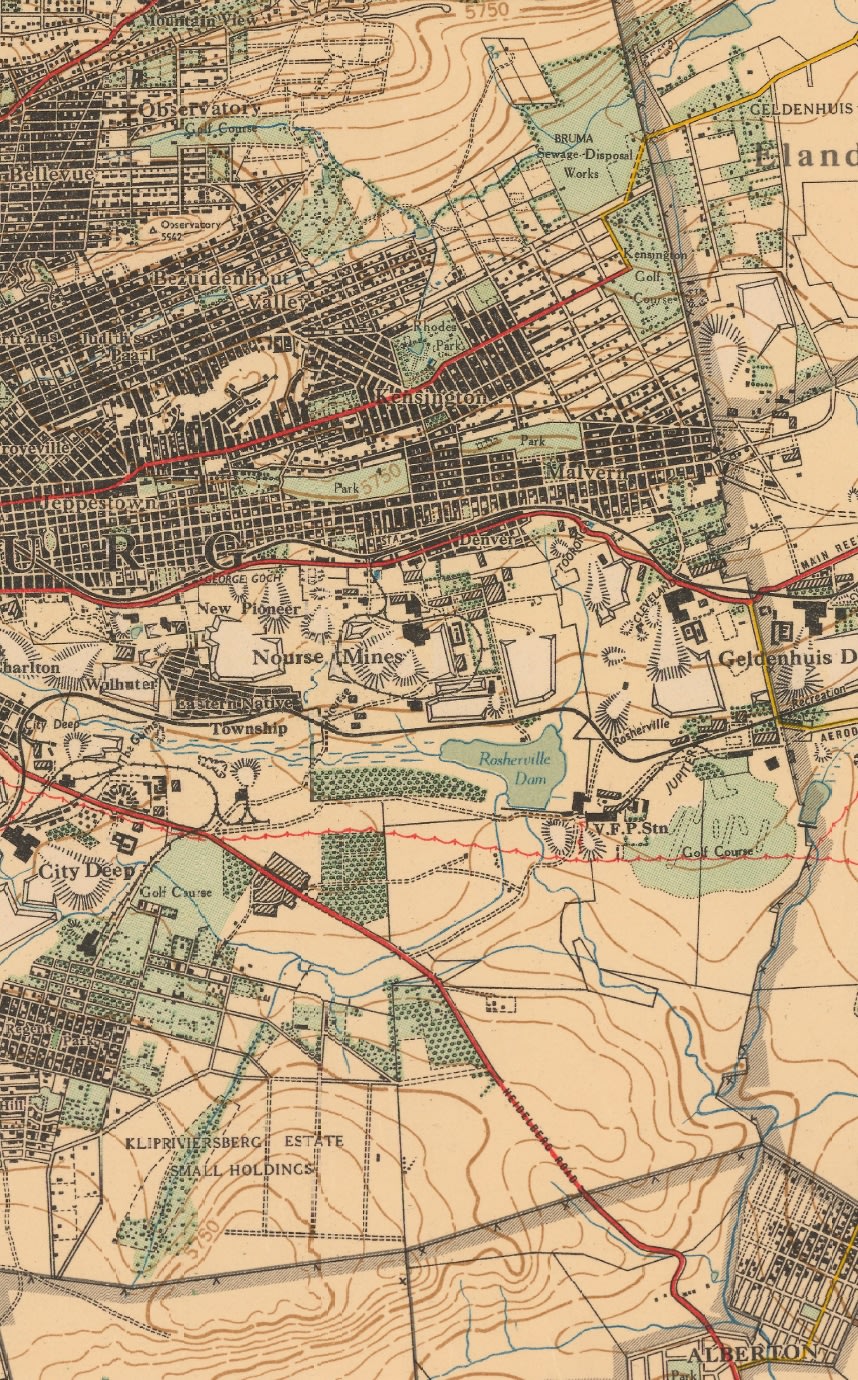
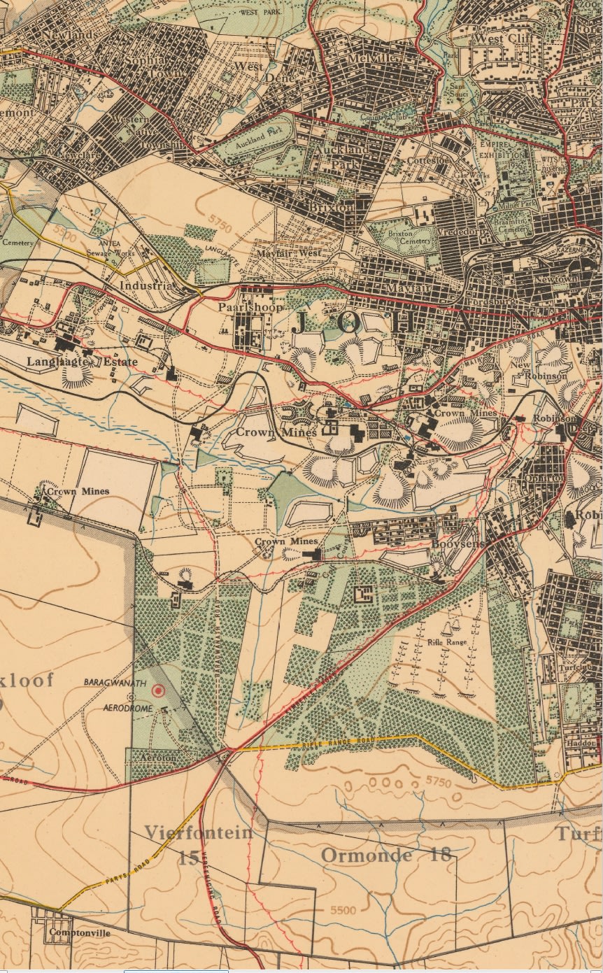
Title: Witwatersrand Central, East and West; Topographical Map 1935, Set of 3 x Maps Digital Download.
Publisher: Surveyor General Office May 1935.
Format: Vintage Printed Maps that have been scanned and saved as PDF images.
Printed Size on a large format printer would be as follows:-
Height: @ 80cm.
Width: 87cm.
File Size: Total of
Total Number of Files: 3 x PDF images @ 16MM - 23MB each
Info: Photolithographed by the Government Printer, May 1935.
Surveyor General Office, Pretoria 1934.
Set of 3 Maps showing the Witwatersrand and Suburbs @ mid 1930's, Gold Mine Properties and places of interest.
Scale: 1: 50 000
On completion of the order and receipt of payment a Dropbox link will be forwarded to your e-mail address for downloading of the files.
Condition: Digital Download.
Price: R 245.00 Inc Vat.
Please Note: When purchasing this item please select the "Collection" option for delivery.
This will ensure that there is no delivery cost involved on the transaction as it is a digital download.