This auction has closed with no winners.
View the relisted Item
View other items offered by Decades2604

Similar products

Free shipping
1859 The United States Of North America Pacific States and The North Atlantic Ocean by J. W. Lowry
Secondhand
R4,999.99
National Geographic Folded Map of The United States September 1982
Secondhand
R295.00
National Geographic Folded Map of The Great Lakes July 1987
Secondhand
R195.00
National Geographic Folded Map of The United States Of America June 1951
Secondhand
R345.00
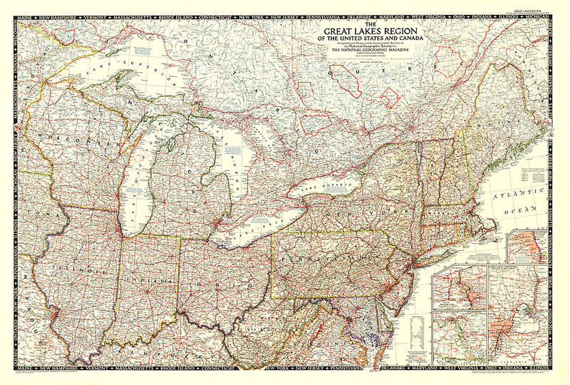
1953 The Great Lakes Region of the United States and Canada. National Geopraphic. 43" x 29" 1953 The Great Lakes Region of the United States and Canada. National Geopraphic. 43" x 29"
Closed

1953 The Great Lakes Region of the United States and Canada. National Geopraphic. 43" x 29"

Secondhand 1 was available
R10.00 minimum increment
R65.00
R75.00
Shipping
R65.00 Standard shipping applies to orders under R100.00, in most areas in South Africa. R35.00 Standard shipping applies to orders over R100.00. Some areas may attract a surcharge surcharge. This will be calculated at checkout if applicable.
Check my rate
The seller allows collection for this item. Buyers will receive the collection address and time once the order is ready.
The seller has indicated that they will usually have this item ready to ship within 5 business days. Shipping time depends on your delivery address. The most accurate delivery time will be calculated at checkout, but in general, the following shipping times apply:
 
Standard Delivery
Main centres:  1-3 business days
Regional areas: 3-4 business days
Remote areas: 3-5 business days
Buyer protection
Get it now, pay later

Product details

Condition
Secondhand
Location
South Africa
Area
Other
Time Period
Post-1950
Type
Cartogram
Product code
WM027
Bob Shop ID
647453343

This map showcases the Great Lakes Region of the United States and Canada. Includes four insets: Illinois waterways (Lake Michigan to Lockport), Welland canal (Lake Ontario to Lake Erie), St. Marys River (Lake Huron to Lake Superior), and Detroit and St. Clair Rivers (Lake Erie to Lake Huron). Published in 1953.


PLEASE NOTE:

ITEMS CAN STILL BE COMBINED. IF YOU NEED ITEMS FROM DIFFERENT ORDERS TO BE COMBINED UNDER ONE SHIPPING, PLEASE SELECT THE "FREE COLLECTION" OPTION ON EVERY ORDER TILL YOUR READY FOR ME TO SHIP, THEN YOU CAN SELECT THE SHIPPING OPTION ON THE LAST ORDER.

WITH THE NEW BOPSHOP CHANGES THIS WOULD BE THE ONLY WAY TO MAKE IT POSSIBLE TO COMBINE ITEMS.

WHEN YOU SELECT THE SHIPPING OPTION, I WILL HAVE TO GO AHEAD AND SHIP THAT SPECIFIC ORDER WITHIN 3 DAYS AS BOBSHOP NOW MONITORS THE DAYS IT TAKES TO SHIP AND THE SELLER WILL HAVE AN EXTRA DEDUCTION FOR SHIPPING IF THEY DON'T COMPLY. TRUST THIS IS IN ORDER. FEEL FREE TO ASK QUESTIONS AT ANY TIME.

Thank you for your support.

Recently viewed

See more
Space Truckers - Jim Mortimore
Secondhand
R44.34
19% OFF
WHITEBOARD MAGNETIC 900*900MM
New
R1,277.92 R1,572.05
76% OFF
Light pink flower baby knitwear for 18M baby
Secondhand
R165.00 R699.00
Urban Industrial Retro Steampunk Pipe Antique Double Toilet Roll Holder Paper Shelf Holder
New
R798.00