National Geographic Folded Map of Europe and the Near East June 1949 National Geographic Folded Map of Europe and the Near East June 1949 National Geographic Folded Map of Europe and the Near East June 1949 National Geographic Folded Map of Europe and the Near East June 1949 National Geographic Folded Map of Europe and the Near East June 1949 National Geographic Folded Map of Europe and the Near East June 1949 National Geographic Folded Map of Europe and the Near East June 1949 National Geographic Folded Map of Europe and the Near East June 1949 National Geographic Folded Map of Europe and the Near East June 1949 National Geographic Folded Map of Europe and the Near East June 1949 National Geographic Folded Map of Europe and the Near East June 1949 National Geographic Folded Map of Europe and the Near East June 1949 National Geographic Folded Map of Europe and the Near East June 1949 National Geographic Folded Map of Europe and the Near East June 1949 National Geographic Folded Map of Europe and the Near East June 1949
National Geographic Folded Map of Europe and the Near East June 1949 National Geographic Folded Map of Europe and the Near East June 1949 National Geographic Folded Map of Europe and the Near East June 1949 National Geographic Folded Map of Europe and the Near East June 1949
National Geographic Folded Map of Europe and the Near East June 1949
+11

National Geographic Folded Map of Europe and the Near East June 1949

Secondhand 1 available
R295.00
Shipping
Free shipping is available from CapeCollectables for all orders above R1,500.00, using one of our trusted couriers.
Check my rate
The seller allows collection for this item. Buyers will receive the collection address and time once the order is ready.
The seller has indicated that they will usually have this item ready to ship within 3 business days. Shipping time depends on your delivery address. The most accurate delivery time will be calculated at checkout, but in general, the following shipping times apply:
 
Standard Delivery
Main centres:  1-3 business days
Regional areas: 3-4 business days
Remote areas: 3-5 business days
Seller
Buyer protection
Get it now, pay later

Product details

Condition
Secondhand
Location
South Africa
Area
Europe
Time Period
1900-1950
Type
Political Map
Product code
8325708
Bob Shop ID
629934615

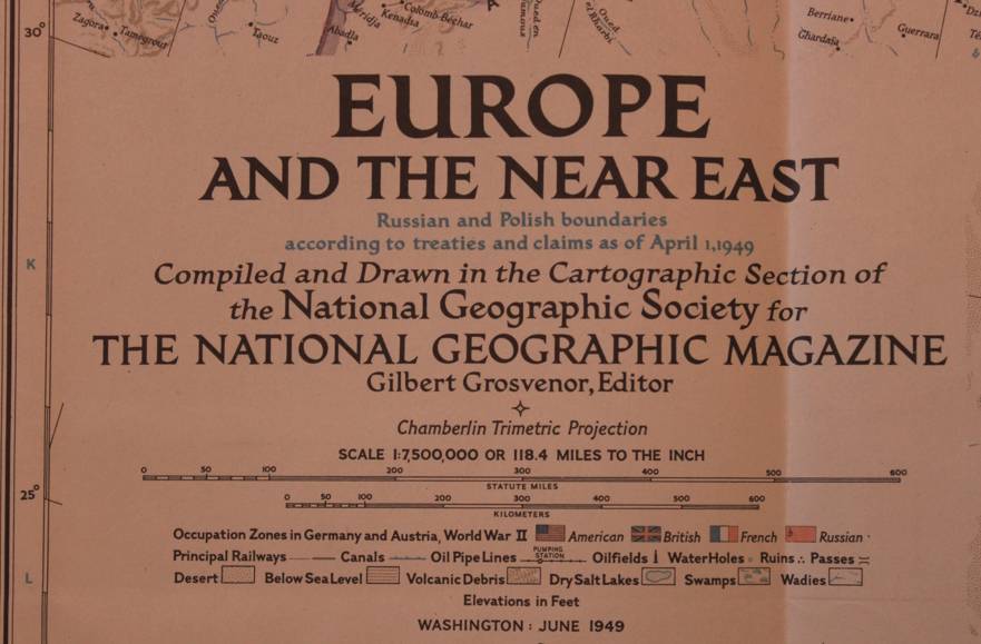
Title: National Geographic Folded Map of Europe and the Near East June 1949
Publisher: National Geographic Society, June 1949.
Format: Folded Map.
Height: 72cm.
Width:  80cm.
Scale: 1: 7 500 000  / 1 Inch = 118.4 Miles.
Info: A folded map of Europe that includes the Near East region with countries from 1949, including Turkey, Syria and Iraq as well as the Northern Africa Coastline.
The Reverse of the Map is blank.
Condition: Very Good, unmarked and unused, the left edge of the map has been trimmed to fit into the Book from 1949.
Price: R 295.00 Inc Vat.


Add to cart

Recently viewed

See more
The Manual of Scales, Broken Chords and Arpeggios
Secondhand
R250.00
HellermannTyton Spanner Insulated 1000V 16mm Ring HT21016
New
R1,198.09
Mom - Never Wrong - Apron
New
R349.00
Contract Reflective Rain Suit (CON-RR)
New
R266.79

Similar products

National Geographic Folded Map of the Classical Land of The Mediterranean December 1949
Secondhand
R295.00
National Geographic Folded Map of Mexico and Central America June 2007
Secondhand
R195.00
National Geographic Folded Map of Ontario June 1996
Secondhand
R195.00
Vintage National Geographic Folded Map of France June 1971
Secondhand
R295.00